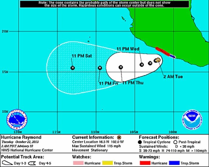
Raymond at 2 a.m. PDT (Courtesy National Hurricane Center)
ACAPULCO, Mexico, Oct. 22 (UPI) -- A weakening Hurricane Raymond was expected to begin moving away from Mexico's Pacific coast Wednesday, weather forecasters said.
Raymond continued to bring heavy rain to parts of south-central Mexico Tuesday but was expected to lose its hurricane status Wednesday.
Raymond was barely a hurricane with maximum sustained winds of 75 mph and was stationary about 105 miles south of Zihuatanejo and about 135 miles west-southwest of Acapulco, the National Hurricane Center said in its 8 p.m. PDT advisory.
The Mexican government replaced a hurricane warning from Tecpan de Galeana to Lazaro Cardenas with a tropical storm warning, and the hurricane watch from Acapulco to Tecpan de Galeana has been discontinued.
Raymond was expected to begin slow and erratic movement during the next day or so and could move closer to the Mexican coast within the hurricane warning area Tuesday, forecasters said.
A slow motion toward the west-southwest is expected to begin Wednesday.
Raymond is expected to produce 4 to 8 inches of rain, with isolated amounts of 12 inches over Guerrero and Michoacan states. The rains could produce flash floods and mud slides.
A storm surge, accompanied by large and destructive waves, is expected to produce significant coastal flooding in areas within the advisories.
Swells generated by Raymond were affecting portions of the south-central Mexican coast. The swells likely will cause life-threatening surf and rip current conditions, the hurricane center said.


