Advertisement

Trimble to provide GPS survey systems for U.S. Marines

By Ryan Maass
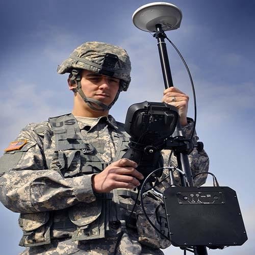
Trimble's M7 GPS-Survey system features software designed for military use, which provides precise positioning technology. Photo by Trimble

SUNNYVALE, Calif., Jan. 14 (UPI) -- The U.S. Navy selected Trimble to supply its GPS Survey systems to the U.S. Marines to be used for topographic missions.

Under the five-year contract, worth an estimated $5.8 million, the company will provide its M7 Anti-Spoofing GPS-S systems, S9 robotic total stations, TSC3 data controllers, the MX2 scanning system, and both field and office software.
Advertisement

The Trimble M7 GPS-S was developed based on U.S. Army Geospatial Center specifications, and is the first and only Selective Availability Anti-Spoofing Module-based GPS survey solution in use by the U.S. military. The equipment is fitted for use in extreme conditions.

Trimble's S9 Robotic Total station enhances accuracy and precision using SureScan and VISION technologies. The station combines scanning, imaging and surveying. Once data is collected, it can be taken back to an office where users can process and analyze it.

The MX2 Mobile Scanning system supports spatial imaging in the field. The MX2 is mounted to a vehicle, and uses both high-resolution laser scanning and precise positioning to gather geo-referenced point data. It uses Trimble's Trident software to quickly collect and analyze raw data.

Advertisement

The company says its equipment will aid the U.S. military in collecting information more quickly during topographic missions, and reduce the time Marines have to spend in hostile conditions.

Latest Headlines