Just after Apple debuted a widely panned maps service, its ex Google Maps has taken Street View below sea level, allowing users to explore the ocean floor from the comfort of their computer or smartphone screens.
The Caitlin Seaview Survey, in a partnership with Google, collected 50,000 360-degree panoramic images of six underwater locations worldwide with the help divers using a special camera called the SVII -- one of only two in the world. Thanks to Google's creepy but awesome Street View technology -- which we've already used to explore cities or spot strange happenings -- users can hop from a Hawaiian beach to its underwater reefs in an instant.
Advertisement
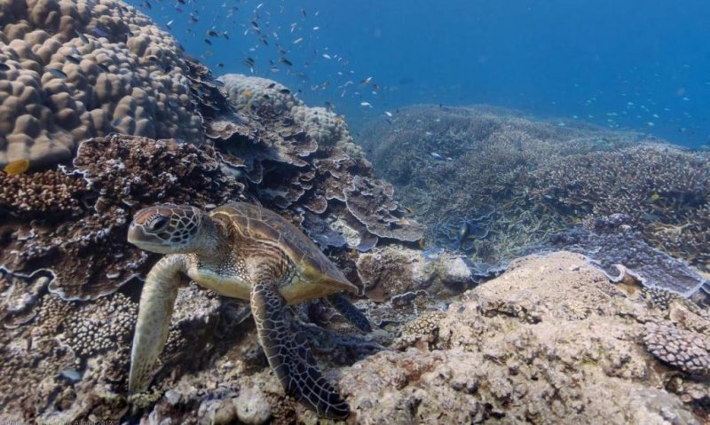
As Google explained in a Tuesday blog post, you can now use Google Maps to explore marine life up close (without the hassle of scuba gear) in Australia, the Philippines and Hawaii. You can meet sea turtles and manta rays, watch the sunset on the Great Barrier Reef or join snorkelers in Hawaii.
"Today we’re adding the very first underwater panoramic images to Google Maps, the next step in our quest to provide people with the most comprehensive, accurate and usable map of the world," said Google Maps and Earth VP Brian McClendon.
Advertisement
Google premiered the following video about the project at the Blue Ocean Film Festival in Monterey, California:
Catlin Survey project director Richard Vevers told BoingBoing that he hoped the project would increase interest in and awareness of ocean conservation issues.
The biggest problem with the ocean is that it's out of sight and out of mind for most of us. 99 percent of people have never gone for a dive and never will. One of the biggest issues around conservation is engaging people with the ocean, and this is a powerful way to accomplish that. It is a scientific project to create a baseline for observing how the oceans are changing, but it also creates awareness of why that matters.
Google Maps' underwater project joins the company's other boundary-pushing mapping endeavors. The service also goes to the White House, selected locations in Antarctica and inside NASA's Kennedy Space Center.