Advertisement

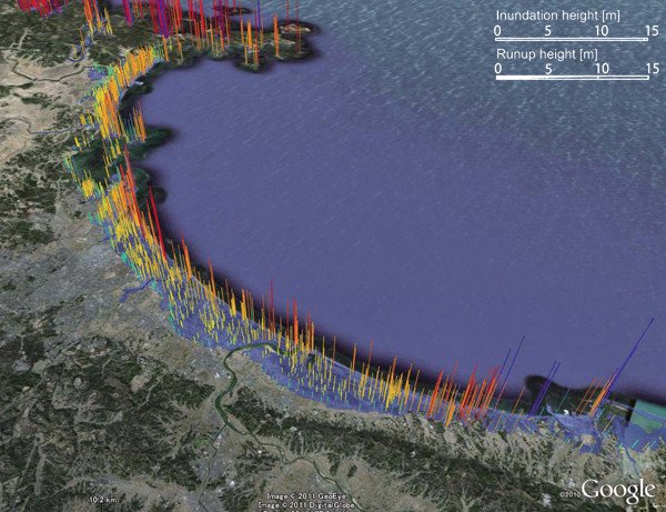
Detailed map of Japanese tsunami created

Survey of 2011 Tohoku earthquake tsunami inundation and run-up. Credit: Mori, N., T. Takahashi, T. Yasuda, and H. Yanagisawa; Geophysical Research Letters

TOKYO, Sept. 27 (UPI) -- Researchers in Japan say they've created a map of the tsunami generated by the deadly March 11 earthquake, surveying 5,300 spots along the country's coast.

The tsunami that devastated large areas of coastal eastern Japan, traveling more than 3 miles inland and killing more than15,000 people, has now been mapped in detail for the first time, researchers report in the journal Geophysical Researcher Letters.
Advertisement

They gathered data in a tsunami damage survey along a 1,200-mile stretch of the country's coast.

Along the coast from about 30 miles to 125 miles north of Sendai, the narrow bays focused the tsunami waves, generating the largest inundation heights and run-ups, researchers said.

On the Sendai Plain, the maximum inundation height was 64 feet above sea level.

The survey data clearly show a regional variation of tsunami characteristics, heights and distance traveled inland, the researchers said.

Latest Headlines