Sept. 29 (UPI) -- While Hurricane Marie remains no threat to land as it swirls in the open eastern Pacific Ocean, forecasters say it could have indirect impacts to portions of Hawaii, Mexico and the West coast of the United States.
Marie became a tropical storm shortly after organizing into a tropical depression on Tuesday. Marie strengthened into a hurricane the following day, making it the fourth hurricane of the East Pacific's season. On Thursday evening, Marie had rapidly strengthened to a Category 3 major hurricane. A major hurricane has maximum sustained winds of 111 mph or greater.
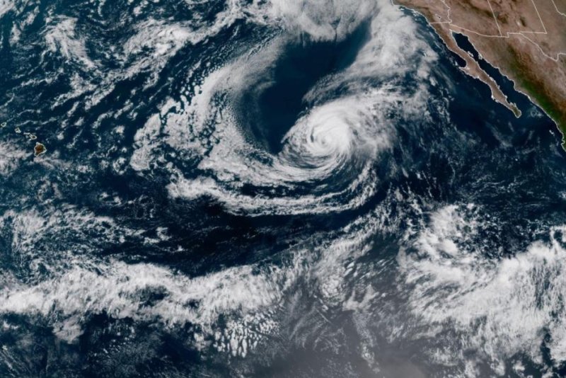
Further strengthening occurred on Friday morning as Marie reached Category 4 hurricane status with maximum sustained winds of 130 mph. On Sunday, Marie had lost wind intensity and had maximum maximum sustained winds of 65 mph, moving northwest at 8 mph in a 5 p.m. HST advisory. The storm was about 1,405 miles west of the southern tip of Baja, Calif.
Marie joined just two other storms in the basin that have achieved Category 4 strength thus far -- Douglas and Genevieve. Douglas tracked just north of the Hawaiian Islands in late July as a Category 1 hurricane by that point in its life cycle. Genevieve generally paralleled the western coast of Mexico during the latter half of August and tracked close enough to Baja California Sur to bring rain and gusty winds.
Marie poses no direct threat to Hawaii, Mexico or the United States, according to forecasters.
"However, large swells generated by the hurricane will propagate outward from the tropical cyclone, reaching the western coast of Mexico and along the coast of California, mostly from Point Conception northward," AccuWeather Hurricane Expert Dan Kottlowski said.
Rough and dangerous surf could also reach the east- and northeast-facing shores of the Hawaiian Islands this week.
Shipping interests are encouraged to monitor the progress of Marie and steer clear of the path of the storm to avoid dangerously high seas.
Forecasters say the hurricane has reached its peak intensity, with weakening likely to continue through early week as it moves on a northwesterly course into cooler waters. Marie will transition to a non-tropical low by the latter half of the week.
"AccuWeather meteorologists are pondering the possibility that some moisture from Marie might circulate toward the California coast from late this week to the second weekend of October," AccuWeather Senior Meteorologist Alex Sosnowski said.
In order for this to occur, a non-tropical storm over the northeastern Pacific Ocean would need to dive far enough south to capture what's left of Marie and fling its moisture northeastward. Conversely, should this non-tropical storm stay farther north, Marie may continue to wander west-northwestward over the East Pacific in its weakened state.
Regardless of which scenario pans out, a pattern change is likely to bring much needed relief from heat and dryness across portions of the West Coast heading into mid-October.
Elsewhere in the East Pacific, a broad area of disorganized thunderstorm clusters to the west of Central America and south of southwestern Mexico is being monitored for possible tropical development this week, according to Kottlowski.
"There is a low to medium chance for tropical development in this area," Kottlowski said.
Including Marie, there have been 13 tropical storms with four hurricanes and three major hurricanes so far this season, which is on par with average. During a typical season, there are an average of 15.4 tropical storms with 7.6 hurricanes and 3.2 major hurricanes in the basin.
Meanwhile, the Atlantic basin has churned out yet another record-setting storm in its historic season -- Gamma. Tropical Storm Gamma will bring flooding rainfall and gusty winds to portions of Mexico into midweek.