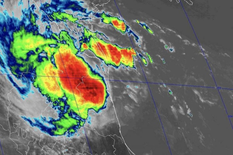
Tropical Storm Fernand is expected to have a short lifespan. Image courtesy of the NOAA
Sept. 4 -- While Dorian will be the most powerful storm over the Atlantic basin the first part of this week, a mass of clouds, showers and thunderstorms over the western Gulf of Mexico recently gave birth to Tropical Storm Fernand, which has moved onshore in Mexico during Wednesday midday, local time.
Tropical Depression Seven formed late Tuesday morning and was upgraded to Tropical Storm Fernand during Tuesday afternoon.
After making landfall, Fernand was downgraded to a tropical depression.
As of 4 p.m. Wednesday, Fernand had maximum sustained winds of 35 mph with higher gusts and was located about 50 miles northwest of La Pesca, Mexico. It was moving west-northwest at 9 mph.
There was a tropical storm warning in effect for Puerto Altamira north to the mouth of the Rio Grande River.
Steering winds will guide the center of Fernand inland over northern Mexico at midweek, where it will dissipate. So this system will have an overall short life span.
However, the large area of downpours and gusty thunderstorms will extend from northeastern Mexico to southern Texas and most notably the lower Rio Grande Valley.
There is the likelihood of torrential rainfall in this area with urban flooding. A general 3 inches and 6 inches of rain is forecast with locally higher amounts to perhaps as much as 10 inches.
People should be prepared for rapid runoff that can lead to mudslides in the mountainous terrain of northern Mexico.
Never attempt to drive through flooded areas as the road may have been washed away beneath the water. The water may also be much deeper than it appears or may be rising rapidly. A foot or two of moving water is enough to wash vehicles downstream.
As with any tropical storm or hurricane that makes landfall, there is the risk of isolated tornadoes and waterspouts. People should keep an eye out for rapidly changing weather conditions and seek shelter at the first sign of an approaching storm or squall.
Some shower and thunderstorm activity from the fringe of the large system can reach as far north as San Antonio. However, any drenching shower or gusty thunderstorm that far north will be brief into Thursday.
Bathers and boaters should expect rough surf and building seas in the region. Rip currents will be stronger and more frequent than average.
Fernand will be steered westward across north-central Mexico later this week where it will diminish, but not before bringing heavy rainfall over the mountains.
Besides Dorian and Fernand, AccuWeather meteorologists are closely monitoring several other tropical systems in the open Atlantic, including Tropical Storm Gabrielle.


