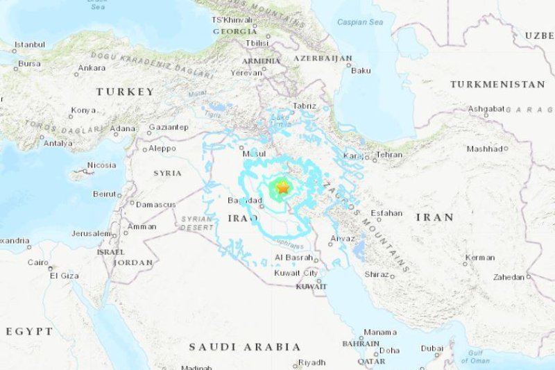
1 of 2 | Western Iran near the border with Iraq was hit by a 6.3-magnitude earthquake on Sunday, the U.S. Geological Survey reported. Map courtesy
USGA
Nov. 25 (UPI) -- An earthquake with a magnitude of 6.3 struck western Iran near its border with Iraq on Sunday, injuring at least 361 people, Iran's semi-official Fars News Agency reported.
Thirteen hours earlier, a 6.0-magnitude quake struck off the eastern coast of Central America at 9:41 p.m. Central time Saturday, the USGA reported.
The earthquake in the Middle East was 21.9 miles north-northeast of Sarpol-e Z̄ahab, Iran, and 39.8 miles south-southwest of Mandali, Iraq, with a depth of 6.2 miles, according to the USGA. It struck at 7:37 p.m. local time. Five aftershocks ranging from 4.1 to 5.6 were recorded up to 6 1/2 hours later.
It was felt as far away as Baghdad, according to Iraqi state media. Iranian state TV said rescue teams were dispatched to the area.
Damage was reported in rural areas in SarPol-e zahab and Qasr-e-Shirin, causing walls of some homes to fall, Fars said in a report by CNN.
"No reports of any fatalities yet and most of the injured were hurt while fleeing, not due to quake damage," Pirhossein Koulivand, head of the state emergency services, told state TV.
Kurdistan 24 reported an official with one of the hospitals said most of the cases were individuals who experienced panic attacks.
Last November, a 7.3-magnitude earthquake hit the region -- Sarpol-e Zahab in Iran's Kermanshah province -- killing nearly 630 people.
The quake in Central America was centered in the Carribbean Sea near the Colombian island of Providencia, 19.9 miles northwest of Mountain, and 259.9 miles west-northwest of Puerto Cabezas, Nicaragua, according to the USGS. The quake was hundreds of miles northeast of Costa Rica and Panama.
It had a depth of 6.2 miles. Six aftershocks ranging from 4.4 to 5.6 occurred up to 17 hours later in region.
The U.S. Tsunami Warning System said the earthquake didn't generate a tsunami and there was no tsunami danger for the U.S. East Coast, the Gulf of Mexico or the eastern coast of Canada.
On Feb. 18, a 5.1-magnitude earthquake struck the Panama-Colombia border region with a depth of 6.2 miles, 73.7 miles east of Jaqué, Panama, according to the USGA.
The area is prone to earthquakes because the Ring of Fire stretches from North and South America to Japan and New Zealand, covering several major faultlines.


