Advertisement

6.5 magnitude earthquake strikes off Indonesia coast, USGS says

By Doug G. Ware
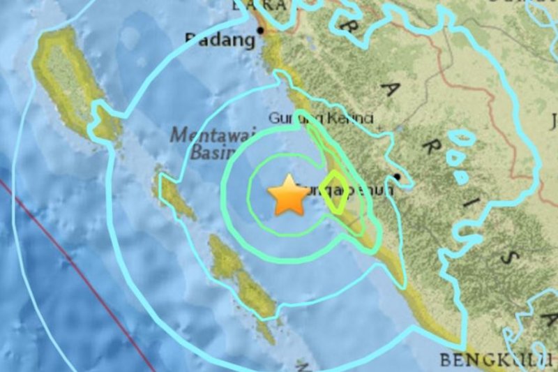
A 6.5 magnitude earthquake struck off the coast of Indonesia Wednesday, as charted above by the U.S. Geological Survey. The quake was so strong it reportedly shook office buildings in Singapore, 330 miles away. Map courtesy U.S. Geological Survey

SUNGAIPENUH, Indonesia, June 1 (UPI) -- A powerful 6.5 magnitude earthquake struck off the coast of Indonesia late Wednesday, U.S. geological officials said.

The quake was centered in the Mentawai Basin, the U.S. Geological Survey said, which is just off the coast of West Sumatra province. It struck just before 6 a.m. local time.
Advertisement

Office buildings in Singapore, more than 300 miles to the northeast, swayed and shook as the tremor hit, Bloomberg reported.

Details of structural damage or injuries were not immediately known. Indonesian officials said the quake did not trigger a tsunami warning.

Seismic activity is common in Indonesia, which is part of the so-called Pacific Rim. Regular convergence between the Indo-Australia and Sunda tectonic plates often results in earthquakes near the Mentawai Basin.

The Pacific Rim also sees regular volcanic activity.

"In addition to the current seismic hazards along this portion of the Sunda arc, this region is also recognized as having one of the highest volcanic hazards in the world," the USGS says on its website. "One of the most dramatic eruptions in human history was the Krakatau eruption on August 26-27, 1883, a volcano just to the southeast of the island of Sumatra, which resulted in over 35, 000 casualties."

Advertisement

Latest Headlines