Advertisement

USGS: Quake in Iran measures 6.3

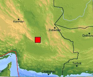
A map provided by the U.S. Geological Survey shows the impact area of the 6.3 magnitude earthquake in red, near the city of Zahedan, population 552,000. Source http://earthquake.usgs.gov/earthquakes/recenteqsww/Maps/10/60_30.php

ZAHEDAN, Iran, Dec. 20 (UPI) -- An earthquake with a magnitude of 6.3 struck southeastern Iran Monday, seismologists in the United States announced.

The event occurred Monday evening and was centered 133 miles southwest of the provincial capital Zahedan and 193 miles east-northeast of the coastal city of Bandar-e Abbas, the U.S. Geological Survey said in a written statement.

Advertisement
There were no immediate Iranian media reports on any damage or casualties from the area.

Latest Headlines