Updated: March 30, 2021 at 4:39 PM
Exploration of Mars through history (54 images)
The United States began the journey to Mars exploration in 1976 when the Viking Lander I successfully landed on the Martian surface. Since then, NASA has made continual efforts to explore and research Mars to eventually have a human mission sent to Mars and on July 30, 2020 launched the Perseverance rover, which landed on Thursday.
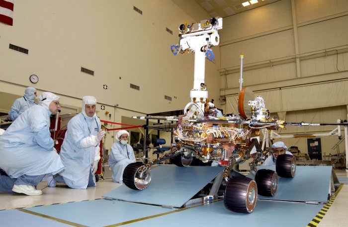
The second of two NASA Mars Rovers is driven over staggered ramps to test the suspension's range of motion before launch. The first of the rovers, Spirit, is scheduled to land on Mars on January 3, 2003. Photo courtesy of NASA
License photo | Permalink

A Boeing Delta rocket lifts off from Cape Canaveral Air Force Station in Florida, carrying NASA's Mars Rover "Spirit" on a seven-month journey to Mars on June 10, 2003. This is the first of two rovers planned to be launched to the Red Planet, signaling NASA's return after six years. Photo by Joe Marino-Bill Cantrell/UPI
License photo | Permalink

This is a false-color image of the surface of Mars as taken by the Mars Orbiter Laser Altimeter, an instrument aboard NASA's Mars Global Surveyor and released on May 27, 1999. It is the first 3D imagery of the Red Planet. This high-resolution map represents 27 million elevation measurements gathered in 1998 and 1999. The massive Hellas impact basin in the Southern Hemisphere, lower left, is nearly 6 miles deep and 1,300 miles across, and is surrounded by a ring of material that rises 1.25 miles and stretches 2,500 miles from the basin center. Photo courtesy of NASA
License photo | Permalink

Astronomers using NASA's Hubble Space Telescope has discovered an enormous cyclonic storm system raging in the northern polar regions of Mars on May 19, 1999. Nearly four times the size of the state of Texas, the storm is composed of water ice clouds like storm systems on Earth, rather than dust typically found in Martian storms. This image has been processed to bring out additional detail in the storm's spiral cloud structures. Photo by Jim Bell, Steve Lee, Mike Wolff/NASA
License photo | Permalink
Advertisement