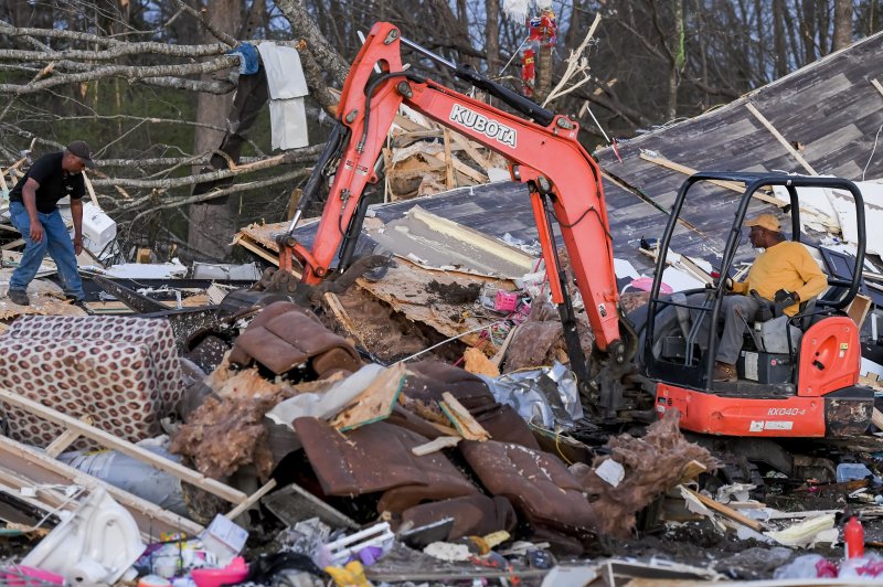
Clean-up efforts from recent heavy storms and tornadoes (such as those in Amory, Miss., this past weekend) will be affected by an ongoing weather system across much of the Southeast. Photo by Thomas Granning/EPA-EFE
As residents of the South recover slowly following the destructive tornadoes that ripped through the region late last week and over the weekend, AccuWeather forecasters say the threat of severe weather will linger a little longer and potentially disrupt ongoing relief efforts.
A stalled front across the southeastern United States has been responsible for round after round of heavy rain and severe weather. More than 200 damaging wind reports and 150 hail reports came in from Friday to Sunday across the region in addition to over 20 reported tornadoes. Cities such as Rolling Fork, Mississippi, and West Point, Georgia, were among the hardest-hit locations during the deadly severe weather outbreak.
"The excessive wet pattern that began across the Southeast late last week is expected to continue into Tuesday due to a stalled front over the region," said AccuWeather Senior Meteorologist Tyler Roys.
This front has provided ideal atmospheric weather conditions for thunderstorms to form the last few days. The clash of cooler air from the north and warm, moist air from the Gulf of Mexico has been a recipe for tumultuous storms to develop.
While showers and thunderstorms may extend from southeastern Texas to North Carolina through Tuesday night, parts of Alabama, northern Florida, Georgia and South Carolina will be at risk for severe thunderstorms through Monday.
"As with previous days, a few isolated tornadoes are possible, in addition to more widespread threats like drenching downpours, damaging winds and hail," Roys explained. Communities around cities like Montgomery, Alabama, and Macon, Georgia, have already endured storm damage from Saturday and Sunday.
Residents in areas that miss out on the more feisty storms should be on alert for heavy downpours and the risk of flooding. This could impact outdoor activities or any cleanup operations from the weekend storms.
The front will regenerate another wave of thunderstorms Monday night into Tuesday following a round of thunderstorms during the day Monday. This time, storms may develop as far south as the Interstate 10 corridor, an area that has largely avoided the severe weather over the last week.
Thunderstorms are likely to follow along the front, leading to training thunderstorms that could hit the same areas repeatedly in just a short time. This will increase the risk of flash flooding for poor-drainage locations in cities like Houston, New Orleans and Mobile, Alabama.
"With the threat of severe weather continuing overnight, residents should be prepared with a reliable way to get severe weather warnings and have a safety plan in place," Roys said.
Through Tuesday night, widespread rainfall totals of more than 2 inches are expected across parts of Louisiana, Mississippi, Alabama, Georgia and South Carolina. A few communities may even receive more than half a foot of rain in less than a week.
Heavy downpours, fueled by the moisture from the Gulf of Mexico, could bring intense rainfall and lead to reduced visibility. This, combined with any ponding on roadways, could be hazardous for motorists and result in slower travel on the highways.
Much of this zone has been particularly dry prior to the recent severe weather outbreak. Some areas, particularly in southeastern Louisiana and the Gulf Coast portions of Alabama and western Florida, still remain in a slight drought, and could certainly use the rain. As of March 26, cities like New Orleans and Pensacola, Florida, reported only about 40 of their average monthly rainfall amounts.
The risk of severe weather is not expected to let up as the week progresses. While the southeastern U.S. is likely to have at least a brief reprieve from severe thunderstorms for the second half of this week, another potent storm is set to deliver damaging storms to the central U.S. from Thursday evening to Friday night.


