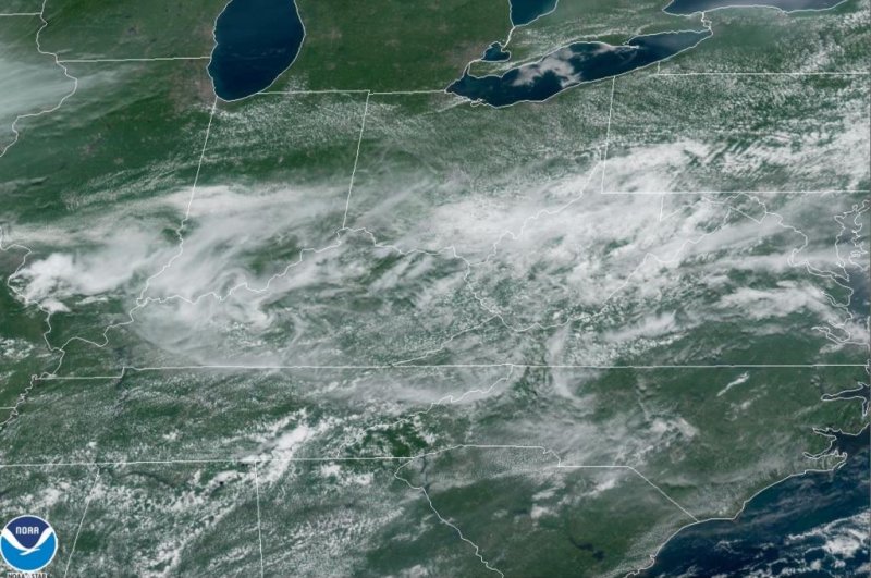
Image shows clouds associated with an advancing storm system in the Ohio Valley and northeastern United States. Photo courtesy National Oceanic and Atmospheric Administration
July 25 (UPI) -- AccuWeather meteorologists caution travelers and those with outdoor plans in the northeastern United States into Sunday evening as locally robust storms will cross the region ahead of a slight drop in humidity levels on Monday.
The same system that sparked dozens of severe weather reports in the Midwest, including several accounts of tornadoes in Michigan on Saturday will pivot through the Northeast into Sunday night.
As humidity levels surge with the southeastward-moving feature, showers and thunderstorms will erupt and move along from the central Appalachians to parts of the mid-Atlantic and New England during the last part of the weekend.
"Even though the extent of severe thunderstorms may be rather low with this system as it rolls through the Northeast into Sunday evening, some communities can be hit hard with high winds, hail and flash flooding in the strongest storms," AccuWeather Meteorologist Jake Sojda said.
The AccuWeather StormMax™ wind gust potential is rated at 80 mph in the strongest storms. At this level, minor property damage can occur along with falling trees and sporadic power outages.
The areal coverage of the locally severe storms is forecast to extend from southern Ohio and northern Kentucky to southeastern New York state and western Connecticut. The threat zone includes the metro areas of Cincinnati; Charleston, W.Va.; Washington, D.C.; Baltimore; Philadelphia, Scranton and Harrisburg, Pa.; Trenton, N.J., and New York City.
People spending time outdoors or on the highways into the evening hours should keep an eye out for rapidly changing weather conditions. Be sure to move indoors at the first rumble of thunder as lightning can strike without notice. Motorists are reminded to never drive through flooded roadways as the water may be rising, much deeper than it appears and/or the road surface may have been washed away.
The air behind this storm system is slightly less humid and humidity levels are forecast to ease down slightly, following the surge in moisture from this weekend.
However, the air coming in on Monday and Tuesday is substantially warmer than the air it is replacing. As a result, temperatures are forecast to climb 5-10 degrees Fahrenheit higher when compared to this weekend. Highs on Monday and Tuesday along the Interstate-95 corridor are forecast to range from the upper 80s around Boston, to near 90 in New York City and the lower to middle 90s in Philadelphia, Baltimore, Washington, D.C., and Richmond, Via. Farther inland highs well into the 80s will be common.
During Wednesday and Thursday, another storm system is forecast to drop southeastward across the region. As humidity levels again climb on Wednesday, coupled with the storm system's moisture and jet stream energy, showers and thunderstorms are forecast to erupt.
Once again, another period of severe thunderstorms is possible from Wednesday around the Great Lakes to Thursday in the Northeast ahead of a push of cooler and less humid air to round out the week.


