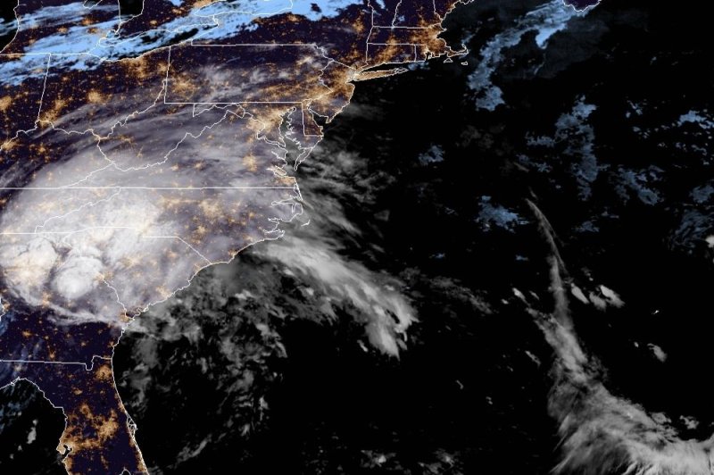
Tropical Depression Sally poured rain over Alabama and Georgia early Thursday. Photo courtesy of NOAA
Sept. 17 (UPI) -- Tropical Depression Sally was dumping torrential rains over eastern Alabama and western and central Georgia early Thursday after making landfall as a Category 2 hurricane the day before, leaving a trail of flooding and destruction in its wake.
Sally had wind speeds of 105 mph, Category 2 strength, when it made landfall before dawn Wednesday, resulting in at least one death in Alabama and downing the Three Mile Bridge in Santa Rosa County, Fla., before losing strength and being downgraded to a tropical depression later in the day.
The National Hurricane Center said in its 4 a.m. CDT Thursday advisory the storm was creating maximum sustained winds of 30 mph and was moving northeast at 12 mph.
The NHC added that the center of the storm was located about 50 miles southeast of Montgomery, Ala.
"On the forecast track, the center of Sally will move across southeastern Alabama this morning, over central Georgia this afternoon and move over South Carolina late tonight into Friday," the NHC said.
Forecasters said Sally could produce as many as 30 inches of rain in some areas between Florida and western Alabama.Sally grew to Category 2 strength early Wednesday after spending most of Tuesday as a Category 1 storm.
Hurricane Ivan, in 2004, was the last hurricane to make landfall in Alabama, as a Category 3 storm. The state saw Hurricane Danny in 1997 and Hurricane Frederic in 1979.
Gulf Coast residents were rushing preparations to completion this week before Sally's arrival -- a little over two weeks after Hurricane Laura's devastating blow in western Louisiana and the upper Texas coast.
States of emergency have been issued by Louisiana Gov. John Bel Edwards, Mississippi Gov. Tate Reeves and Alabama Gov. Kay Ivey and mandatory evacuations were ordered in low-lying areas of Mississippi and Louisiana.
Sally was the earliest named "S-Storm" to ever form in the Atlantic Ocean basin, beating out 2005's Hurricane Stan, which was named on Oct. 2.
In less than 24 hours, Sally went from being a mass of showers and thunderstorms east of the Bahamas on Friday to a tropical depression before growing into a tropical storm Saturday.
There is also the potential for brief tornadoes and waterspouts to spin up near and east of the center of the storm as it crawls inland. On Tuesday morning, tornado watches were issued by the National Weather Service for coastal Alabama and the western half of the Florida Panhandle.
After moving inland, the storm will lose wind intensity, but continue to pull moisture northward into the Deep South.
AccuWeather meteorologists said that natural gas and oil production is expected to be shut down for one day to two days in the north-central Gulf as Sally moves through the region, but the majority of the rigs are located farther west, over the western Gulf of Mexico.
Sally isn't the only system meteorologists are monitoring. Hurricanes Paulette and Teddy are also in the Atlantic basin, along with Tropical Storm Vicky.
Hurricane season does not officially end until the end of November, and forecasters say that named systems could emerge into December this year.


