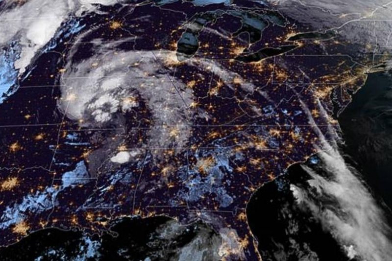
The remnants of Tropical Storm Cristobal are seen over the U.S. Midwest early Tuesday, where they are forecast to produce strong winds and rain in the Mississippi River Valley. Image courtesy NOAA
June 9 (UPI) -- The remnants of Tropical Storm Cristobal are moving into Missouri, prompting watches and warnings in parts of the Mississippi Valley and Great Lakes regions.
The National Hurricane Center said in its 4 a.m. update the center of the storm is about 80 miles southeast of Springfield, Mo., and has maximum sustained winds of 30 mph.
A flash flood watch is in effect for areas in and near the length of the Mississippi Valley, it said. Tropical Storm Cristobal was downgraded to a tropical depression early Monday.
Cristobal thrashed its way into records books before and after it made landfall Sunday in southern Louisiana. The system struck with tropical storm strength by Grand Isle, La., and swamped much of the rest of the Gulf Coast.
With its formation last week, it became the earliest C-named storm in recorded history. By reaching land on Sunday, it became the second-earliest named storm to impact Louisiana, as only Tropical Storm Arlene from 1959 made landfall earlier in the calendar year, on May 30.
But Louisianians didn't have time to think about the historical context as they prepared all weekend and hunkered down on Sunday. With over 20,000 residents without power by Monday morning, communities throughout the southern portion of the state have cleanup to address.
Power has since been restored to a majority of customers, as of Monday night.
Roadways and highways were flooded hours before the storm arrived as an intense storm surge brought the highest water level in years. In Grand Isle, mandatory evacuations were ordered for the island on Saturday.
"This is the highest water the island has seen since Isaac," Jefferson Parish Councilman Ricky Templet said, recalling the August 2012 Category 1 hurricane that made landfall in southeastern Louisiana, to NOLA.com. "Grand Isle is 7 miles long. We only have 2 miles of the island that's passable."
Before Cristobal arrived, strong rip currents from the system claimed the lives of two children swimming at a beach in Grand Isle on Friday night and left two others hospitalized, according to WWL TV.
The destruction mounted on Sunday night after landfall, as the storm packing 50-mph winds moved inland over Louisiana. According to Harrison County Emergency Management Director Rupert Lacy, a portion of the Biloxi Lighthouse pier in Mississippi was destroyed by the waves on Sunday, the Sun Herald reported.
As shown by video and pictures shared, the high winds pushed parts of the pier over a half mile down the beach.
River flooding across Mississippi and Louisiana is expected to remain a concern in the areas even though Cristobal and its impacts have moved northward. By Biloxi, the U.S. 90 ramp to Mississippi 619 Jerry St. Pé Highway in Jackson County remained flooded Monday morning.
Gusty winds continued pushing water from Lake Ponchartrain into nearby communities and causing flooding concerns on Monday.
In Mandeville, Louisiana, located along the northern shores of the lake, some residents elected to navigate flooded roads with kayaks rather than cars. Even at low tide, the community was inundated with storm surge.
As the system continues its rare northerly track, damage reports are likely to continue mounting, particularly as river flooding persists across portions of the lower Mississippi basin, according to meteorologists.
Earl Etheridge, public safety director for Jackson County, told the Sun Herald conditions could have been much worse if the storm strengthened to hurricane status.


