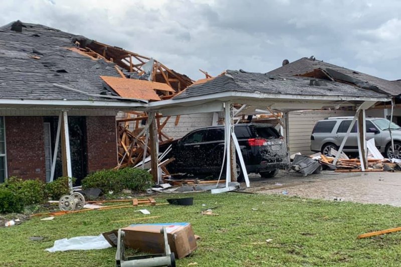
Damage from the tornado is seen in Monroe, La., on April 12. Photo courtesy Monroe Fire Department
There will be no rest for the storm-battered South as forecasters say another round of severe weather looms at the end of the weekend.
Communities across the South continue to clean up from the most violent outbreak of severe weather yet this year which occurred during Easter weekend. Recovery and relief efforts across the region have faced complications due to the coronavirus pandemic.
A storm system encountering warm, humid air from the Gulf of Mexico will bring another round of heavy rainfall and severe weather from Texas through the Southeast Sunday into Monday morning, according to AccuWeather Meteorologist Tyler Roys.
Winds can gust to an AccuWeather Local StormMax of 80 mph in the most severe thunderstorms. Such gusts can turn debris lingering on the ground from the Easter weekend outbreak into dangerous projectiles and cause damage and power outages in other communities.
The thunderstorms could also spell trouble for tents and canopies set up at outdoor triage and testing centers for COVID-19.
AccuWeather has offered free severe weather notifications to COVID-19 testing and triage medical facilities, including temporary sites that may be particularly vulnerable to violent thunderstorms.
In addition to the damaging winds, large hail, downpours and tornadoes can occur.
AccuWeather meteorologists do not expect the number of tornadoes with this event to come near the total of 155 from Easter Sunday.
"However, all it takes is for one tornado to strike a community to cause widespread destruction and potentially cause loss of life. And the event from Sunday to Sunday night is still likely to produce multiple tornadoes," AccuWeather Senior Meteorologist Alex Sosnowski said.
Timing of the worst weather will be Sunday afternoon and night from eastern Texas to the lower Mississippi Valley and Deep South, and Monday morning along the Southeast coast.
Residents from Houston to Shreveport and New Orleans, La.; Jackson, Miss.; Birmingham, Mobile and Montgomery, Ala.; Atlanta and Savannah, Ga.; Pensacola, Tallahassee and Jacksonville, Fla.; Charleston and Myrtle Beach, S.C.; and Wilmington, N.C., should make sure they have a way to be notified when severe weather is imminent.
Flash flooding is likely to be another significant threat with this system.
Widespread rainfall totals of 2-4 inches are expected within and to the north of the severe weather zone.
Some locales in the region already received heavy rain Saturday night into Sunday morning. Starkville, Miss., recorded 1.69 inches of rain Saturday night, while New Orleans received 2.29 inches late Saturday afternoon into Saturday evening. The additional heavy rain and storms expected Sunday and Sunday night will exacerbate the flooding threat in the region.
"An AccuWeather Local StormMax of 6 inches is anticipated, which can be enough to cause not only urban flooding, but also a rapid rise on small streams," Sosnowski said.
Motorists are urged to not venture into floodwaters as the water may be deeper than it appears and the roadway underneath could be washed away.
Drier weather will sweep in behind the storms early this week, but the region may be in the crosshairs of yet another severe weather event during the middle and latter part of the week.
"In terms of severe weather and tornado risk, the overall weather pattern is loaded for the rest of April and into May," AccuWeather Lead Long-Range Meteorologist Paul Pastelok said.


