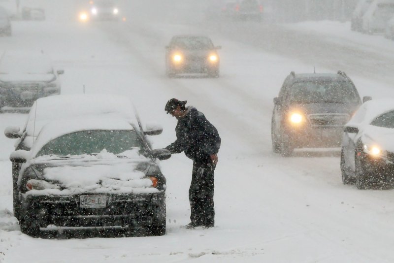
A motorist clears his car from snow as traffic makes its way through downtown St. Louis during a snow storm in St. Louis on Monday, December 16, 2019. Photo by Bill Greenblatt/UPI |
License Photo
A long-tracking winter storm could deliver the most substantial snowfall of the season across portions of the central United States, including cities like Chicago and Oklahoma City, as it is predicted to affect a 1,500-mile corridor this week.
Winter storm watches and warnings had been issued from West Texas to Illinois by midday on Tuesday, and AccuWeather meteorologists warn that the winter storm will disrupt daily commutes, school and long-distance travel from Tuesday night into Thursday.
The main storm will follow a preliminary dose of light snow that will coat areas from northeastern New Mexico to northern Missouri into Tuesday evening.
![]() |
| A far-reaching storm will unload snowfall across the central United States during the middle of this week. (NOAA / GOES-EAST) |
Temperatures plummeted into the single digits in Denver as snow from the first system moved into the area Tuesday morning, just two days after the high climbed into the mid-70s. The same system unleashed double-digit snowfall totals farther west in Utah. Salt Lake City International Airport was buried under record snow on Monday when 8.6 inches of snow fell. That amount shattered the Feb. 3 record of 7 inches, which had stood since 1936.
This lead storm is helping to usher in colder air that will lay the groundwork for moderate to heavy snow farther to the southeast at midweek.
Major cities, including Oklahoma City, Chicago, Detroit and Columbia, Mo., are expected to be blanketed by a 3- to 6-inch snowfall. For these locations and many others, the approaching weather system has the potential to be the biggest single snowstorm of the winter so far -- and an AccuWeather Local StormMax of 10 inches is forecast along the storm's route.
"Snowfall for the season has been near to below normal across this corridor," AccuWeather Senior Meteorologist Carl Erickson pointed out.
Chicago has recorded three snow events of 3 inches or more this season. Its biggest single-day snow total this season is 3.4 inches -- from a storm that hit on Oct. 31 and another that hit on Nov. 11. The Windy City picked up 3.1 inches on Jan. 17.
Oklahoma City has seen almost no snow so far this season. Apart from picking up a tenth of an inch on Jan. 22, the city has recorded no other measurable snowfall.
Detroit is a different story. Its biggest snow event of the season was from a storm that dropped 8.5 inches on Nov. 11. And on Jan. 18 Detroit saw an accumulation total of 6.8 inches. If AccuWeather's StormMax total hits Detroit, the storm could be the biggest of the season to date for the Motor City.
Since the storm is targeting major population areas and airport hubs in the region, travel disruptions could be substantial. Airline passengers should anticipate flight delays and cancellations stemming from the major hubs of O'Hare International, St. Louis International and Detroit Metro airports.
Around Oklahoma City, the morning commute on Wednesday will be a mess. Travel conditions around St. Louis are likely to be rough throughout Wednesday.
Both the morning and afternoon commute on Thursday around Chicago and Detroit have the potential to be slow and slippery. Some schools may close during the storm due to the poor road conditions.
The Kansas City area in Missouri is likely to be grazed by the midweek storm but will be in the thick of the cold air. Flurries could evolve into steadier snow as the Chiefs' victory celebrations continue.
A slight shift in the storm track by as little as 50-100 miles could move the heaviest swath of snow a bit farther to the northwest or southeast. Even so, a broad area of 1- to 3-inch snowfall is likely from portions of the southern High Plains to the middle Mississippi Valley and the lower Great Lakes region.
The storm will travel along the boundary between cold air to the northwest and warm air to the southeast. The zone of stark temperature changes will be set up a few hundred miles to the southeast of where the snow falls.
A cold rain will fall over lower portions of the southern Plains and the Ohio Valley. In between the rain and snow, freezing rain and sleet can occur across a narrow area.
In some cases, snow will follow a period of ice as temperatures dip and a rapid freeze-up occurs. The icy conditions can occur in such places as Abilene and Wichita Falls, Texas; Tulsa, Okla.; Fort Smith, Ark.; Springfield, Mo.; St. Louis; Lafayette, Ind.; and Toledo, Ohio.
AccuWeather RealFeel Temperatures are forecast to be in the single digits, teens and 20s in locales expected to receive snow and ice.
Forecasters say motorists should be prepared for slow, difficult and, in many cases, dangerous travel along portions of interstates 20, 35, 40, 44, 55, 57, 65, 69, 70, 72, 74, 80, 90 and 94.
The wintry precipitation will end from west to east across the southern Plains on Wednesday, then the middle part of the Mississippi Valley later Wednesday night and Thursday morning. The bulk of the snow will depart the Great Lakes region by Thursday night, but a large area of snow showers is forecast to linger over the Midwest through Friday evening.
It is possible that a sneaky storm will bring snow or a wintry mix to portions of the Ohio Valley this weekend, which will largely be missed by the midweek storm.


