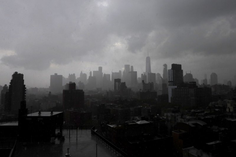
1 of 2 | Dark, ominous clouds leading to severe thunderstorms move in over One World Trade Center and the Manhattan skyline in New York City on Monday. Photo by John Angelillo/UPI
|
License Photo
July 22 -- After a deadly heat wave that was responsible for four deaths in Maryland baked the northeastern United States over the weekend, violent thunderstorms and torrential downpours will sweep into the region on Monday and signal an end to the torrid weather.
The storms will form along the leading edge of an abnormally cool air mass advancing southeastward across the Midwest.
"When an unusually strong cold front slashes into an unusually hot and humid air mass, severe weather can be expected, and that will be the case on Monday," AccuWeather Senior Meteorologist Adam Douty said. "The strongest thunderstorms will produce flooding downpours and damaging wind gusts."
Flooding created a travel nightmare for the Monday morning commute around St. Louis, where 3-5 inches of rain poured down.
Rounds of drenching rain and thunderstorms moving eastward through the Ohio and Tennessee valleys were forecast to intensify as they moved into the mid-Atlantic later Monday afternoon and evening. The hot and humid air still holding its ground east of the Appalachians will serve as the fuel necessary for thunderstorms to rapidly intensify and expand in coverage.
Cities most at risk for feisty storms Monday include Allentown, Philadelphia and Harrisburg, Pa.; Trenton and Atlantic City, N.J.; New York City; Wilmington and Dover, Del.; Richmond and Charlottesville, Va.; and Baltimore and Washington, D.C.
AccuWeather meteorologists don't see a threat of tornadoes on Monday, but they said brief isolated spin-ups cannot be ruled out.
"Flight operations may be halted for a time at airports throughout the region," AccuWeather Senior Meteorologist Kristina Pydynowski said. "It may also be a slow ride home during the evening rush hour as motorists can face reduced visibility and a heightened risk of vehicles hydroplaning."
Trees and power lines can be brought down by any gusty thunderstorm and result in power outages. In addition, shingles can be torn off roofs, and loose outdoor objects can be tossed around and potentially be turned into dangerous projectiles. There will also be an enhanced risk for flooding into Monday night from the central Appalachians into the mid-Atlantic.
While a general 1-2 inches of rain is forecast in this swath, the hardest-hit locations could receive as much as 4-5 inches of rain. Flooding of streets and low-lying areas will be common through Monday night and some smaller streams and creeks may not be able to handle the higher rainfall rates and could overflow their banks.
Tuesday, although the risk for severe weather will be confined to southeastern Virginia and the Carolinas, any additional rainfall will prevent flooded streams and creeks from receding and spoil outdoor sporting events. Temperatures will be slashed by some 10-20 degrees from Washington, D.C., to Philadelphia and struggle to reach the 80-degree mark. A much welcome reduction in the oppressive humidity will follow by the middle of the week in the wake of the wet weather.
High temperatures that reached the century mark in Baltimore and parts of Philadelphia over the weekend will be replaced by highs in the 80s by midweek.
For residents sick of the sweltering heat and humidity, the September-like air mass will provide a much safer setting for prolonged, outdoor activities such as hiking, running, biking and golfing. The pleasant air and dry weather should stick around through at least the end of the week before muggier air begins to creep back into the Northeast by the weekend.


