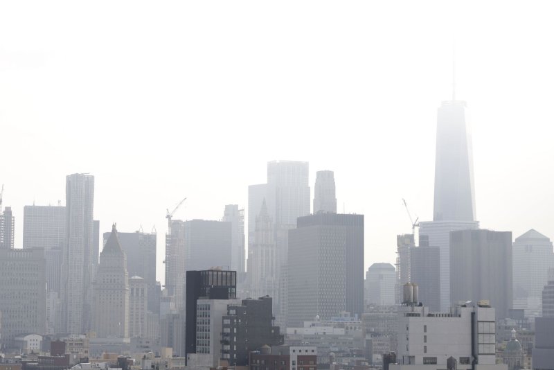
Haze surrounds One World Trade Center and the Manhattan skyline on a high humidity summer day in New York City on Thursday. The tri-state area is bracing for the worst potential heat wave of the year with temperatures expected to reach near 100 degrees Fahrenheit on Saturday. Photo by John Angelillo/UPI |
License Photo
July 18 (UPI) -- While the Midwestern and Northeastern United States will continue to swelter in dangerous heat and high humidity into this weekend, an upcoming pattern flip is in store that will allow cooler and less humid air to push southward from Canada.
AccuWeather estimates that more than 87 million Americans live in an area where a daily record-high temperature could be set on Saturday.
![Friday RF]()
The summer scorcher will throttle up into this weekend with daily record highs in the 90s to near 100 F on the bubble and AccuWeather RealFeel Temperatures forecast to spike near 110 in some urban areas for several hours during the late morning and afternoon.
Temperatures around 100 F are possible in the cities of Washington, D.C, Baltimore, Philadelphia, New York City, Boston, Chicago and St. Louis, to name a few.
![RF Saturday]()
At this level, the hot July months of the past in 2012, 2011, 1991, 1980 and 1930 will be rivaled. Forecast temperatures are 10 to 15 degrees above average even for the middle of summer.
![heat lingers sunday realfeel]()
However, near-100-degree temperatures with high humidity is significantly different than that of the typically low humidity locations of the Southwest.
Both areas are dangerous in the heat, but with the combination of vast paved areas and heavy population, the health risk is significantly higher for more people in the humid regions.
![Record Highs Sat]()
For a time, it may feel just as hot in Washington, D.C., as Death Valley, Calif. While the actual temperature may be higher in Death Valley when compared to the nation's capital, humidity levels near the Chesapeake Bay will be substantially higher than that of the deserts.
For example, dew point temperatures will range from the teens to the lower 30s in the deserts, but will be in the 70s to the lower 80s near the Chesapeake Bay. The dew point is the temperature that the air becomes saturated with water vapor when the air is cooled. When this happens, the relative humidity reaches 100 percent.
![realfeel dc death valley]()
Temperatures in many of the major cities may struggle to drop below 80 at night which then allows the heat to build at an even faster pace the next day. Nighttime humidity levels can be significantly higher than the afternoon as a result.
Unlike the Deep South, many more people in these northern and mid-latitude locations are not used to long stretches of high heat and humidity and may not handle it as well as those who have spent a long time in the South's weather conditions.
![Heat Wave NE Through Sunday]()
When the temperature is combined with high humidity, sunshine and other weather factors, RealFeel Temperatures can be 5 to 15 degrees higher than the actual temperature.
Why the heat is no laughing matter
In the forecast conditions, perspiration fails to evaporate quickly and the body temperature can climb significantly, followed by heat exhaustion and heat stroke.
Heat kills more people on an annual basis than any other weather-related factor.
![Weather Fatalities]()
Until the pattern breaks, strenuous physical exercise and manual labor should be limited. If these activities must take place, they should be avoided during the hottest part of the day and frequent breaks from the heat are highly recommended.
Remember to increase the intake of non-alcoholic fluids and frequently check on young children and the elderly.
Avoid walking pets and barefoot on paved and concrete areas during the late morning and afternoon hours as these surfaces can become hot enough to cause severe burns to paws and feet.
When will it break?
Storms will rim the heat from the northern Plains to the Great Lakes and New England on a periodic basis through this weekend. These storms will tend to keep the heat at bay over the northern tier but can bring brief relief a bit farther south.
However, even in the middle of the geographical swelter, the heat wave will not last for weeks.
For those who can't handle the heat or hoping for one of those breaks in the heat that the northern states often get, cooling relief will gather momentum this weekend near the Canada border and push southward as next week progresses.
The jet stream pattern is forecast to make a major change. The jet will shift southward in the Central and Eastern states and bulge northward in the West next week.
![Next Week US Jet]()
Daytime highs and nighttime lows in some areas may be slashed by as much as 20 degrees.
This means that highs in the 90s to near 100 will be replaced by highs ranging from the middle 70s across the north to near 90 in the south.
![Monday Cooldown 3 pm]()
At the peak of the cooling, toward the middle of the week, nighttime lows will dip to the 50s across the north and over the central Appalachians to the 60s across the south and in the large metro areas.
![Relief 3 pm]()
Even people over the interior South are likely to catch some relief. This includes the Tennessee Valley, southern Appalachians, Piedmont and lower Chesapeake Bay region.
As the cool air begins to make its move, showers and thunderstorms are likely to erupt. Because of the very hot and humid air, there is the potential for severe thunderstorms.
The front is likely to stall over the Deep South next week, which can result in a stormy time for the South Central and Southeastern states. However, in many of these areas, daily thunderstorms are not likely to wait until next week.


