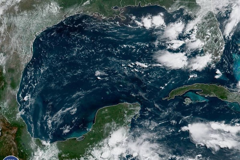
This is a satellite image taken Sunday of the Gulf of Mexico. There is concern for tropical storm development in the northeastern Gulf of Mexico with potential impacts to residents and visitors later this week. The Atlantic basin had a month of inactivity. Image courtesy National Oceanic and Atmospheric Administration
After more than a month of inactivity in the tropical Atlantic basin, there is concern for development in the northeastern Gulf of Mexico with potential impacts to residents and visitors later this week.
A non-tropical system tracking through and triggering showers and thunderstorms across the South early this week will eventually end up over the warm waters of the eastern Gulf of Mexico around midweek.
"The storm will then sit over the eastern Gulf of Mexico for a few days and may eventually become partially or fully tropical in nature during the time period from late this week into next weekend," according to AccuWeather Senior Meteorologist Adam Douty.
Dry air, dust and strong wind shear has prevented tropical development across the Atlantic basin since Subtropical Storm Andrea briefly roamed the waters of the west-central Atlantic in late May.
![New tropical July 7]()
However, more conducive conditions exist over the eastern Gulf of Mexico.
With strong wind shear absent, warmer-than-normal waters of the eastern Gulf of Mexico can allow an organized tropical or subtropical system to take shape.
The next tropical storm in the Atlantic basin would be called Barry.
A subtropical storm has both tropical and non-tropical characteristics, but can be just as impactful in terms of heavy rain, rough seas and strong winds.
"One of the keys to whether a depression or storm will form is how close the system tracks to the coast," Douty added. "The longer the system remains over water, the stronger it may become," he said. "However, it may stay non-tropical if it sits near land."
Regardless of development, the system may lead to multiple days of showers and thunderstorms that can spoil vacation and outdoor plans across the Southeast this week.
Flood dangers can arise in areas that get hit repeatedly by downpours or where a more concentrated band of heavy rain unfolds.
"Based on latest indications, residents from western Florida to eastern Louisiana should especially remain alert for an increase in downpours and heightened risk for flooding later this week and into the start of the weekend," Douty said.
The downpours may start to ramp up over western and northern Florida around midweek before spreading westward, depending on the storm's eventual track.
![flooding July 7]()
"If the system does strengthen into a named tropical storm, damaging wind would also become a concern near its center," Douty added.
Seas would turn dangerously rough for boaters and swimmers as the storm strengthens.
Latest indications keep the potential tropical storm east of the majority of the oil rigs and refineries along the Gulf coast, but AccuWeather meteorologists will continue to closely monitor the system for any westward trends that could lead to more significant disruptions.
After the system leaves the Gulf of Mexico, its eventual track will determine whether heavy rain aims for the Tennessee Valley or the Carolinas starting later next weekend.
AccuWeather Hurricane Expert Dan Kottlowski has been warning since early April that the Gulf of Mexico, as well as areas east of Bermuda and off the southeastern coast of the U.S. need to be watched closely for early season development due to water temperatures running above normal.
![Pattern July 7]()
AccuWeather's 2019 predictions have not changed since the initial forecast was released on April 3.
Forecasters continue to call for 12 to 14 tropical cyclones this season. Of those, five to seven are predicted to become hurricanes and two to four are predicted to become major hurricanes.
While El Niño conditions may suppress the numbers of tropical storms and hurricanes in the Atlantic basin somewhat this year, all it takes is for one or two hurricanes to strike populated areas and result in great risk to lives and property.
Tropical Storm Emily from 2017 was the last time that a named tropical system made landfall in the United States during the month of July. Emily formed in the eastern Gulf of Mexico and moved into the central Florida Peninsula on the last day of July.


