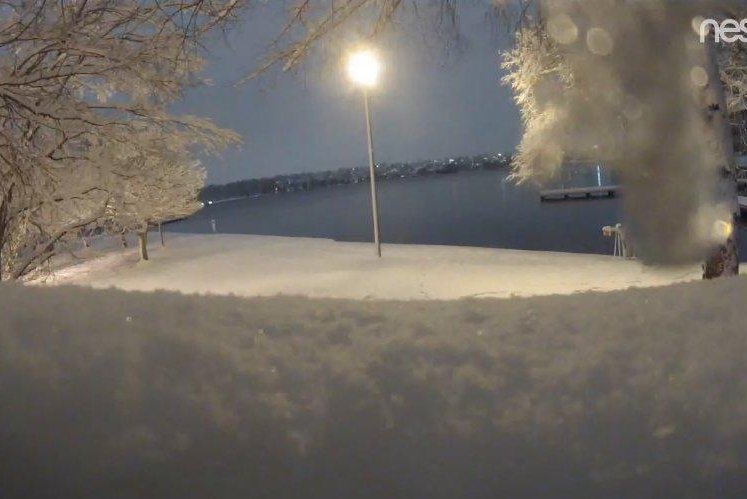
A webcam at Seattle's Green Lake shows a wintry scene Saturday morning. The city was hit by more than half a foot of snow Friday. Photo courtesy National Weather Service Seattle/Twitter
Feb. 9 (UPI) -- The state of Washington has been hit by a major snowstorm as Seattle recorded more than half a foot of snow by Saturday morning, topping the city's yearly average.
Seattle-Tacoma International Airport reported 6.4 inches of snow Friday and 7.9 inches by 10 a.m. Saturday, according to the National Weather Service in Seattle. The city averages about an inch less than that annually, NWS meteorologist Jacob DeFlitch told The Seattle Times.
It was the second-largest snowfall recorded in one day in the past 20 years, only exceeded by 6.8 inches on Jan. 18, 2012, according to the NWS. It's also the fourth time the region has had 6 inches of snow in one day since 1991. The most snow in one day at the airport was 20 inches on Jan. 13, 1950.
In February, 10.6 inches of snow fell in Seattle, which is the snowiest since 13.1 inches in 1949.
Elsewhere, 21.5 inches were reported along the Port Angeles foothills and 10.7 inches in the city. Eighteen inches were tallied in Agnew, 16 inches in Sequim and 11 inches in Port Orchard.
The NWS calculated 2.5 inches of new snow equates to 0.15 inches of liquid. "That's quite fluffy by Seattle standards," the NWS tweeted.
Snow started to taper off Saturday morning but more snow is on the way through Sunday and another storm is possible next week, according to NWS meteorologists.
"This pattern really is not going to change over one or two weeks," DeFlitch said. "It will continue to be colder than average and there are chances for additional snow."
More than 15 million people across the Western United States were under winter storm alerts Saturday morning, according to CNN meteorologist Haley Brink.
Gov. Jay Inslee declared a state of emergency Friday.
"Everyone in our state needs to focus on preparing for the snow and staying safe," Inslee said in a statement. "Weather forecasters predict this may be a storm unlike one we've seen in many years. I encourage everyone to stay off the roads if possible and plan ahead if you must travel."
In Seattle, the city was using 34 vehicles to plows, salt and de-icing roads with 14 hand crews shuvoeling sidewalks in the center city, according to Mayor Jenny Durkan's office.
Residents are also dealing with gusty winds and cold temperatures.
"Winds gusting to 30-40 mph across most of Washington will cause blowing and drifting of snow to continue, especially east of the Cascades, on Saturday," Dan Pydynowski, an AccuWeather senior meteorologist said.
Gusts could reach 60 mph in the northern Puget Sound and Olympic region.
Seattle's high is forecast for 35 degrees Fahrenheit with the normal high 49 degrees, CNN's Brink said. The windchill would feel like it's in the teens.
The weather is creating treacherous road conditions as local law enforcement urged people to stay off the roads.
Officials shut down a 20-mile stretch of Interstate 90 east of Ellensburg due to blowing and drifting snow and poor visibility.
The Interstate-5 corridor, including Siskiyou Summit in Oregon, will be difficult to use.
The storm also is affecting flights.
At Sea-Tac, 223 outgoing and incoming flights were canceled and 298 were delayed Saturday, according to Flight Aware through 3 p.m. Fewer flights also were disrupted at Portland International.
In Washington, nearly 53,000 people were without power, including nearly 26,000 in Thurston County, according to Poweroutage.us as of 3 p.m. Saturday.
Earlier this week, about half a foot of snow hit some area of Seattle from an earlier snowstorm.


