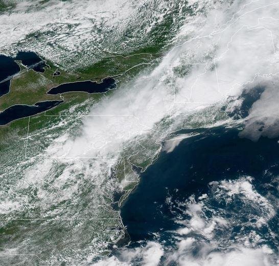
A cold front is expected to bring torrential downpours across much of the Northeast Tuesday, as a similar pattern in the Midwest is expected to last through mid-week. Image courtesy NOAA
July 17 (UPI) -- Torrential rain and gusty winds are expected as thunderstorms erupt along a cold front across the Great Plains on Tuesday, a pattern expected to last through mid-week.
A strong cold front is also producing the potential for storms to unleash downpours and strong winds in the Northeast Tuesday, possibly causing travel headaches at airports and on roadways.
AccuWeather Senior Meteorologist Mike Doll said the repeating and slow-moving nature of the Mid-west storms combined with the high moisture content could create flash flooding and cause power outages from strong wind gusts. Lighting will also be abundant.
"In one hour, during Tuesday morning, there were more than 2,000 lightning strikes in central Kansas alone," Doll said.
Areas at risk for flooding and locally damaging winds will extend from southeastern Nebraska and southwestern Iowa to central and eastern Kansas, western Missouri, eastern Oklahoma and western Arkansas.
In the Northeast, the National Oceanic and Atmospheric Administration's Storm Prediction Center issued a severe thunderstorm watch until Tuesday at 7 p.m. EDT for most of Massachusetts, northern Connecticut, northern Rhode Island, southern Vermont, southern New Hampshire, far southern Maine and part of southeast New York.
These slow-moving storms could cause airport delays and problems for the evening rush hour in Boston, Hartford, Conn., New York City, Philadelphia, Baltimore and Washington D.C.
Damaging wind gusts are possible with these storms, which could cause downed trees. Local urban flash flooding is also a possibility.
On Wednesday, dry weather conditions and lower humidity will return to the Northeast as the front pushes off to sea.


