Advertisement

Images show 5.3-magnitude quake rattle Southern California

By Sara Shayanian
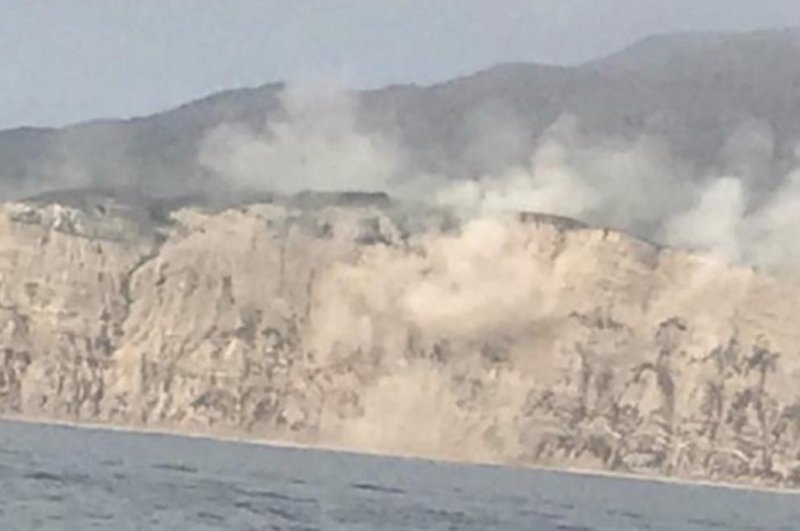
A view of cliffs on Santa Cruz Island shows dust movement during the 5.3-magnitude earthquake on Thursday. Photo courtesy Ventura County Fire Department/Twitter
1 of 2 | A view of cliffs on Santa Cruz Island shows dust movement during the 5.3-magnitude earthquake on Thursday. Photo courtesy Ventura County Fire Department/Twitter

April 6 (UPI) -- The 5.3 magnitude earthquake that hit off the coast of Los Angeles moved the earth a bit, which was captured on cameras.

The epicenter of Thursday's quake was 6 miles below the surface 23 miles east-southeast of the Channel Islands -- roughly 85 miles due west of Los Angeles.
Advertisement

The quake was the strongest to hit Southern California in years, but did not cause major damage.

The shaking caused landslides on Santa Cruz Island, which was close to the epicenter.

The Ventura County Fire Department shared photos of the ground moving on coastal cliffs, and a webcam captured a bald eagle and three chicks reacting to the swaying ground.

Kayakers who were inside a cave at the time of the quake described rocks falling near them.

"It was a quick jolt, it actually didn't last very long," Brandon Roberts, who was in Santa Cruz at the time of the quake, told KCAL-TV. "But it was actually very intense."

Advertisement

Latest Headlines