Advertisement

Severe weather produces large hail, tornado in South

By Eric DuVall
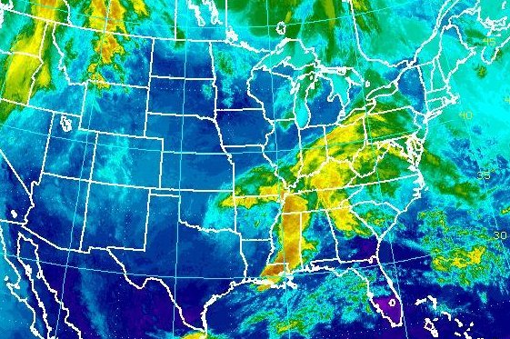
A low pressure system is expected to bring 1-2 inches of rain stretching from the Louisiana Gulf Coast north to the Carolinas on Friday The storms produced damaging hail and a tornado in Oklahoma on Thursday. Image courtesy NOAA

May 12 (UPI) -- A line of thunderstorms brought grapefruit-sized hail and isolated tornados to parts of Oklahoma and Arkansas on Thursday, meteorologists said.

Damage was reported to homes and vehicles due to the hail. A tornado that touched down in Rogers County, Okla., destroyed outbuildings and left debris strewn across its path. About 4,400 people in Tulsa and Owasso, Okla., lost power, according to the Tulsa World.
Advertisement

The National Weather Service gave the twister an initial grade of EF-1, the least powerful on a scale of five.

In Coyle, Okla., teachers and students took cover in interior rooms at a local school as tennis ball-sized hail smashed car windshields and the building's windows.

No injuries were reported in any of those instances.

The threat continues into Friday before the low pressure system moves out into the Atlantic, Weather.com meteorologist Linda Lam said.

"The risk of a few severe thunderstorms will stretch from the lower Mississippi Valley into portions of the Southeast, with the primary concerns being damaging wind gusts and large hail," Lam said. 

Minor flooding was expected in lowland areas surrounding local creeks and streams throughout the day Friday due to runoff from the storm.

Advertisement

The system is expected to continue moving east, bringing severe weather in the form of high wind, hail and heavy rain stretching from New Orleans through Alabama and north to Atlanta and Charlotte, N.C., on Friday.

Latest Headlines