Advertisement

Tropical Storm Ana makes landfall in Carolinas

By Marilyn Malara
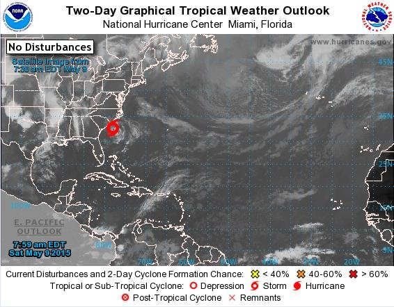
The National Hurricane Center is issuing advisories on Tropical Storm Ana, but cyclone formation is not expected in the next five days. Photo by National Hurricane Center/NWS

CAPE FEAR, N.C., May 9 (UPI) -- Tropical Storm Ana made landfall north of Myrtle Beach, N.C. at 6 a.m. Sunday.

The National Hurricane Center said the storm would weaken as it remained on land, but maintained a tropical storm warning for both Carolinas. The storm is expected to turn north, and with maximum sustained winds of 40 mph, the service said "Interests elsewhere in eastern North Carolina and Virginia should monitor the progress of Ana."
Advertisement

The first named storm of the 2015 Atlantic storm season arrived early, about a month before the season's official start date, and is expected to affect the coasts of North and South Carolina Sunday morning, according to the National Hurricane Center.

As of 8:00 a.m. Saturday, Ana's center was moving north-northwest at a speed of about 5 mph, 3 mph faster than Friday. Maximum wind speeds may reach 60 mph, with even higher gusts, the report says.

The storm is expected weaken as it enters the cooler waters of the eastern coastline and is not expected to reach cyclone formation.

Tropical storm warnings are in effect from the coasts of South Santee River, South Carolina, to Cape Lookout, North Carolina. Residents in the area should expect high winds, storm surge up to 2 feet and up to 3 inches of heavy rainfall.

Advertisement

Life-threatening rip currents are also expected to occur off the southeastern coast.

The National Weather Service urges those in the surrounding areas to monitor the progress of the storm as it approaches landfall.

Latest Headlines