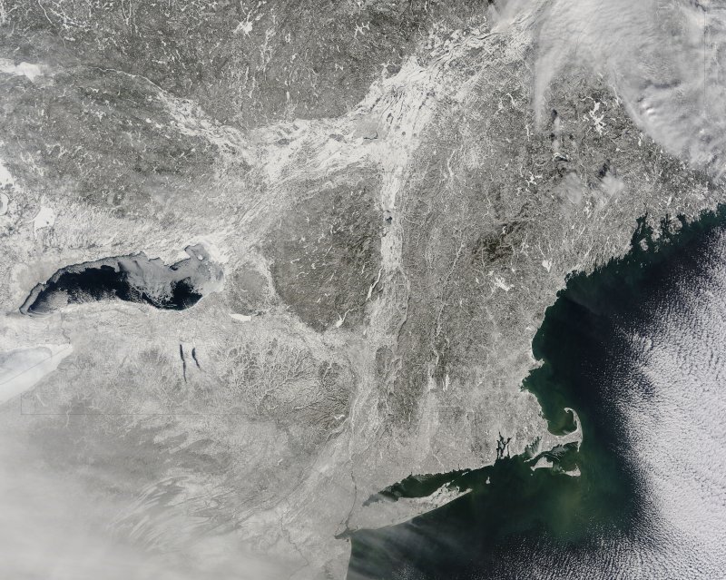
1 of 6 | Multiple winter storms since the beginning of the year have blanketed the U.S. Northeast with snow in this photo from Wednesday. Photo by NASA
BOSTON, Feb. 19 (UPI) -- Though it's been a particularly brutal winter this year -- and expected to get worse in the coming days -- the frigid temperatures and high snowfalls have made for some stunning images caught by satellite.
A NASA satellite on Tuesday caught an image of a snow-blanketed Northeastern United States. Storm after storm since the beginning of 2015 have dumped snow all over the region and in recent days, portions of the South have also seen some of the white stuff.
Boston has been particularly hard hit and is just 11 inches shy of breaking its previous record for yearly snowfall total -- 107.6 inches in the 1995-96 season. The city is expected to get more snow Saturday and could be pummeled by a another significant storm in the middle of next week.
The snow accumulation even highlighted another recent extreme weather event in Massachusetts. NASA satellite imagery picked up a scar left by a tornado in Springfield. The EF3 rated tornado created a path of damage in West Springfield, Springfield and Brimfield and killed three people in 2011.
![]()
A scar of damage from a 2011 tornado in Springfield, Mass., is highlighted by snow cover. Photo by NASA
Tornado scars can often be seen from space, but a heavy covering of snow makes them all the more visible.
Meanwhile, plunging temperatures are sending the Great Lakes region into a deep freeze. Niagara Falls froze by midweek and now scientists say nearby Lake Erie has 98 percent ice cover.
George Leshkevich, of the Great Lakes Environmental Research Laboratory, told USA Today it's not just Lake Erie that's experiencing greater ice coverage.
"The Great Lakes as a whole experienced 85.4 percent ice cover as of yesterday," he said Wednesday. "Nobody expected 2014 to be as bad as it was, almost record breaking for ice cover and this year it's the same thing with these very cold temperatures."
The nearly completely frozen lakes were captured by NOAA satellites Tuesday.
A winter storm that stretched from the south-central United States to the Mid-Atlantic coast this week broke several low temperature records. Lexington, Ky., hit 7 degrees below zero, the coldest since January 2003, Bowling Green was at 7 below, its coldest since January 1994 and Embarrass, Minn., was at a mind-boggling 41 below.
Cold temperatures are expected to break some six dozen records from New England to Florida on Friday, The Weather Channel predicts. More heavy snow is also expected in the Great Lakes region and interior Northeast.


