Advertisement

State logging guidelines in area of deadly Washington mudslide based on old map

Logging guidelines based on old maps may have contributed to the deadly mudslide in Washington State, the Seattle Times reported.

By Frances Burns
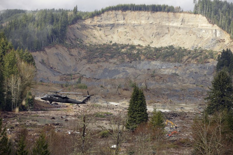
A military search and rescue helicopter hovers over the debris field on March 27, 2014 in Oso, Washington. Over 200 search and rescue personnel continue to search for survivors or bodies in the aftermath of Saturday's mudslide that buried the town of Oso, about 12 miles west of Darrington. As of Thursday, there are 25 dead and 90 missing. UPI/Ted Warren/Pool
A military search and rescue helicopter hovers over the debris field on March 27, 2014 in Oso, Washington. Over 200 search and rescue personnel continue to search for survivors or bodies in the aftermath of Saturday's mudslide that buried the town of Oso, about 12 miles west of Darrington. As of Thursday, there are 25 dead and 90 missing. UPI/Ted Warren/Pool | License Photo

Logging guidelines based on old maps may have contributed to the deadly mudslide in Washington State.

The Seattle Times reports that the state Department of Natural Resources drew up guidelines in 1997 based on a 1988 map, although the state report cited the work done in 1997 by geologist Daniel Miller and Joan Sias, a hydrologist. The Times said its analysis of the area found 12 additional acres would have been protected from logging based on the 1997 map.
Advertisement

“We did the work. It was cited in the prescriptions as what you should do. And it appears from your comparison of the maps that it didn’t get done,” Miller told the newspaper Sunday. “I suspect it just got lost in the shuffle somewhere.”

The mudslide last week buried an area of about a square mile on the Stillaguamish River near the village of Oso, including part of a highway. The death toll stood at 21 Monday with about 30 people unaccounted for.

Grandy Lake Forest was allowed to clear cut 7 1/2 acres in 2004 and 2005, including 5 acres that would have been protected using Miller's map, the Times said. The area that was logged just touched the slope that collapsed last week.

Advertisement

Logging increases the instability of steep slopes because the trees absorb water from the soil.

[Seattle Times]

Latest Headlines