Advertisement

Google Maps show non-existent island

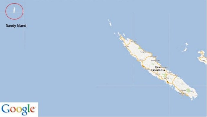
Sandy Island, between Australia and New Caledonia, as shown on Google Maps. Credit: Google

MOUNTAIN VIEW, Calif., Nov. 23 (UPI) -- A South Pacific island roughly the size of Manhattan and clearly marked on online maps and marine charts isn't there, researchers say -- it doesn't exist.

The island, called Sandy Island by Google Maps and Sable Island on others and supposedly 60 square miles was nowhere to be seen when an Australian scientific research vessel sailed to -- and through -- its reported coordinates.
Advertisement

"We saw this mysterious island on all the scientific maps and weather maps but not on this one navigational chart that was on our ship," doctoral student Sabin Zahirovic on board the RV Southern Surveyor told CNN.

"So we decided to go see if it was actually there."

The Southern Surveyor sailed through the area where Google Maps and other charts said the island was supposed to be, he said.

"We were watching all of our depth-sounding equipment. Luckily for us the sea floor turned out to be very deep there," said Zahirovic.

A Google representative told CNN keeping up with changes and revisions is a "never-ending endeavor" and Google was always open to integrating new information received from users.

Advertisement

Latest Headlines