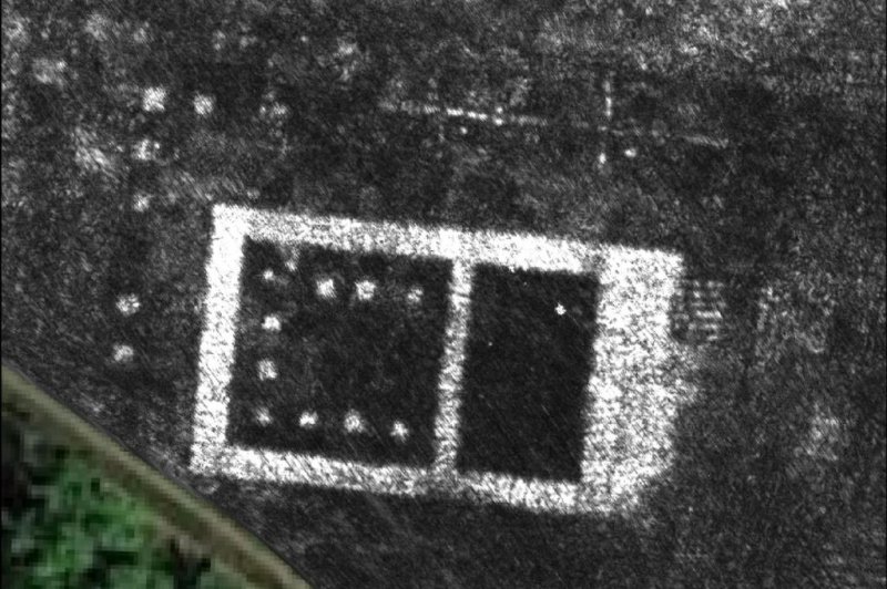
1 of 2 | Scientists used ground-penetrating radar to survey an entire Roman city without any digging. Pictured, the temple at Falerii Novi, Italy. Photo by L. Verdonck
June 8 (UPI) -- Archaeologists have, for the first time, mapped an entire Roman city without lifting a shovel or moving any dirt. The dig-free survey revealed the contours and composition of Falerii Novi, an ancient city located 30 miles north of Rome.
Using high-tech ground penetrating radar, or GPR, researchers were able to map the city's bath complex, market, temple, a public monument and an expansive network of water pipes.
Radar has been around for a while, but the technology has only recently gotten precise enough to use for surveying underground cities. Advances in computing power have also helped scientists deal with the massive data sets produced by GPR surveys.
For the latest survey, scientists used a quad bike to pull GPR devices back and forth, ultimately revealing a city that was surprisingly architecturally elaborate.
Researchers were also surprised by the placement of so many important structures along the outer edge of the city.
"Archaeologists very often focus on the town center," lead researcher Martin Millett, professor of classics at the University of Cambridge, told UPI in an email. "Here there are key buildings around the edges."
Falerii Novi was a city of modest dimensions, about half the size of Pompeii, comprising 31.5 hectares, or just more than a tenth of a square mile. The city, located on a slight volcanic plateau in Italy's Tiber River Valley, was occupied as early as 241 BC. During the 3rd century BC, the city housed as many as 2,500 inhabitants.
The sensitivity of the radar allowed scientists to precisely measure the depths of different parts of the city, revealing which structures were built first and how the city evolved over time.
Ground-penetrating radar surveys can do more than just show the outlines of buildings and city walls. They can reveal the economic and political significance of ancient cities and towns, offering important insights into daily life in Ancient Rome.
"By mapping the city, and others like this, we can identify the types of structure including things like workshops and shops, thereby seeing how many there are, where they were within the city, etc.," Millett said. "This enables us to make a much better assessment of the overall functions of the city and thus better assess things like their economic and political importance."
In some places, ground-penetrating radar is the only tool archaeologists have. The ground under which Falerii Novi is buried is protected as a state monument by the Italian government. Other ancient cities are buried beneath modern infrastructure.
Even when digging is possible, radar can help archaeologists conduct more targeted excavations.
"It is best used in conjunction with other remote sensing techniques -- like magnetometry -- as different methods map different physical properties and so are complementary," Millett said.
Researchers hope their work, published Monday in the journal Antiquity, will inspire the use of ground-penetrating radar for the surveys of larger ancient cities.


