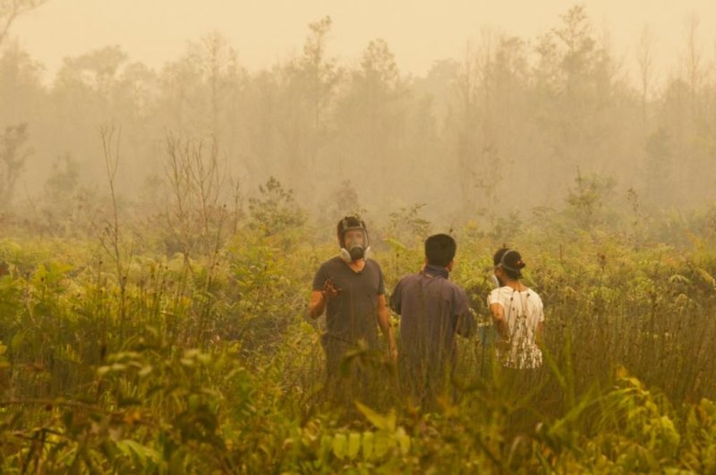
In 2015, drought and degraded soil combined to fuel hundreds of peatland fires across the island of Borneo. Photo by Aulia Erlangga/CIFOR
Sept. 9 (UPI) -- Researchers have developed a new method for analyzing satellite data to gauge the fire susceptibility of peatlands.
Peatlands offer extremely efficient carbon sequestration services. When they burn, high concentrations of CO2 are released into the atmosphere. Over the last 30 years, peatland fires in Asia have been increasing in size, severity and frequency.
"Although they only cover 3 percent of the world's land area, peatlands are estimated to contain 21 percent of the world's soil carbon," Nathan Dadap, doctoral candidate at Stanford University, said in a news release.
Dadap and his colleagues developed a new method for identifying regions of peatland most likely to burn. Their breakthrough was only possible as a result of the degradation of peatland forests in the region.
The conversion of so many tropical forests into palm oil plantations, allowed scientists to measure varying soil moisture levels across the region. Ironically, the region's environmental degradation could end up helping officials protect and prevent fire among the most vulnerable patches of peatland.
Using satellite data and a new algorithm, scientists developed a way to gauge soil moisture across Asian peatlands. Currently, officials use precipitation to monitor fire risk, but authors of the new study -- published Monday in the journal Environmental Research Letters -- claim soil moisture is a more accurate predictor of fire susceptibility.
"The problem with using precipitation as an indicator is that it doesn't take into account the local conditions," Dadap said. "If one area has drainage canals and another does not, but you still have the same amount of precipitation, the one with canals still is going to have a much higher risk of fires. That's why we think that inclusion of soil moisture can be an important metric for capturing conditions on the ground."
Researchers were able to test the accuracy of their algorithm by comparing their findings with the results of a laboratory-based peat ignition study.
Peatland fires burn fast and spread quickly. They are extremely difficult to control. In 2015, drought and degraded soil combined to fuel hundreds of peatland fires across the island of Borneo. The massive fires caused extreme air pollution, which was blamed for 100,000 premature deaths in Indonesia, Malaysia and Singapore.
In studying the relationship between moisture levels and 2015 fires -- using data from NASA's Soil Moisture Active Passive mission -- researchers identified a key threshold. Below a certain level of moisture, ignited peatland fires tend to get especially big.
"That was probably the most shocking finding, since we were measuring soil moisture from the satellite -- it was a totally different method than this laboratory ignition study," Dadap said. "It was a pleasant surprise to have an independent comparison that seems to match up really well."


