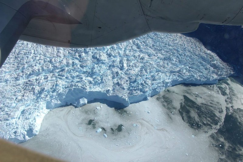
NASA scientists have returned to Greenland to conduct aerial surveys of the island's coast and measure the height of its glaciers. NASA Photo by John Sonntag/UPI |
License Photo
March 14 (UPI) -- NASA scientists are back in Greenland to find out if encroaching ocean waves are accelerating the melting on the underside of just a few unlucky glaciers, or if the ocean poses a major threat to the entirety of the island's ice.
The latest research campaign is part of NASA's Oceans Melting Greenland program. Since 2016, researchers have conducted two or three field campaigns per year. Scientists continue to look for new ways to measure the effects of ocean currents and waves on the undersides of Greenland's melting glaciers.
"We've seen some really surprising results that suggest the oceans have a huge effect on Greenland's biggest glaciers," Josh Willis, principal investigator on the OMG mission and a scientist at NASA's Jet Propulsion Laboratory, said in a news release. "This year, we hope to figure out whether the ocean's impact is widespread or if it's just a few big glaciers that care about ocean temperatures."
The mission's newest phase will feature the same research strategies and instruments. For the third year in a row, scientists will gather data using a NASA G-III aircraft outfitted with the agency's Glacier and Ice Surface Topography Interferometer.
However, updated technology will provide even more precise measurements of Greenland's coastal glaciers.
"It's never the same," said JPL engineer Ron Muellerschoen. "We're always trying to push the limits of what we can look at in the field. There's new hardware, new configurations for installing equipment on the plane, and we have a new recording system."
Radar maps produced using GLISTIN-A data reveal the heights of every glacier along Greenland's coast. When compared to maps produced during previous campaigns, scientists can used the latest radar numbers to estimate ice loss.
As part of the latest research campaign, OMG scientists will continue to chart ocean temperatures along the coastline. Researchers will also continue to improve their maps of the ocean floor surrounding Greenland.
"With these combined data sets, scientists have a complete view of Greenland's 200 or so coastal glaciers and how they are responding to changes in the water below and the air above them," NASA announced in a news release.
Last year, scientists on the OMG missions were able to determine why a glacier in northwest Greenland has been melting much faster than its neighbors. Scientists determined the quickly melting glacier features a deeper underwater terminus, exposing it to a low-lying layer of warm ocean water.


