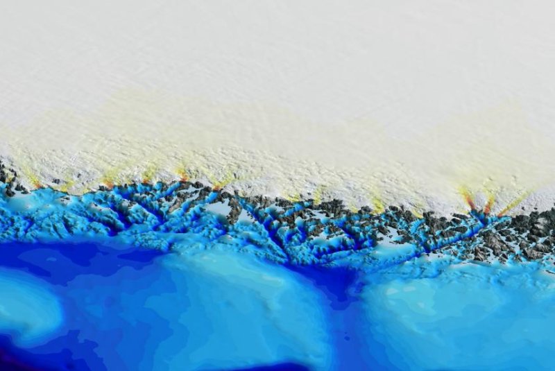
NASA data helped scientists build accurate maps of Greenland's coastland. The contours of the coastal seafloor help scientists make more accurate estimates about the shapes of the island's inland bedrock. Photo by Mathieu Morlighem/UCI
Nov. 2 (UPI) -- Greenland's glaciers are more vulnerable to accelerated melting than previously thought, according to new maps detailing the contours of the island's coast seafloor and bedrock.
The new maps -- the most precise and comprehensive relief maps of Greenland yet published -- were plotted using data from 30 different research institutions.
Bathymetric data provided by NASA's Ocean Melting Greenland was essential to the mapping effort, researchers say.
Bathymetric data describes the shape and depth of the seafloor. By mapping the contours of the coastline, where glaciers flow into the sea, researchers can make more accurate estimates about the shape of bedrock farther inland.
"What made OMG unique compared to other campaigns is that they got right into the fjords, as close as possible to the glacier fronts," Mathieu Morlighem, a researcher at the University of California, Irvine, said in a news release. "That's a big help for bedrock mapping."
Some of the data collection and map making marked the first time researchers have plotted the contours of specific fjords.
The seafloor and coastal mapping data was supplemented by data from NASA's Operation IceBridge mission, which measures the thickness of the ice sheet directly below the research plane's flight path. The long, narrow strips of data can be pieced together to form an accurate map of ice thickness.
Supplemental data from a variety of research organizations and academic institutions helped round out the new maps, offering scientists a better understanding of how ice is flowing across the contours of Greenland.
The maps -- detailed in the journal Geophysical Research Letters -- between two and four times as many glaciers extend beyond 600 feet below sea level. Surface water temperatures surrounding Greenland are frigid, but water beneath 600 feet is delivered from farther south and is several degrees warmer, which means a larger percentage of Greenland's glaciers are vulnerable to accelerated melting than previously realized.
"These results suggest that Greenland's ice is more threatened by changing climate than we had anticipated," concluded Josh Willis, scientist at NASA's Jet Propulsion Laboratory.


