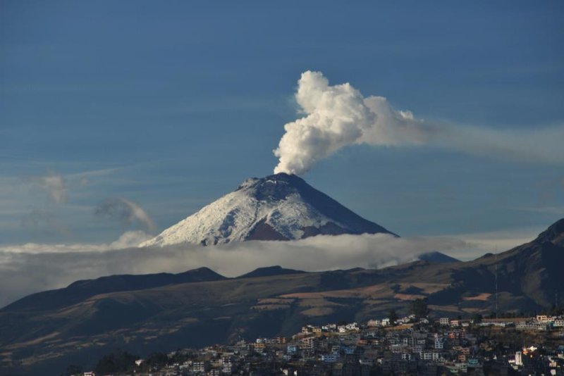
Researchers suggest the next eruption of Ecuador's Cotopaxi will preceded by tremors, gas emissions and ground inflation, just as it was in 2015. Photo by University of Miami
Aug. 7 (UPI) -- Scientists have developed a new algorithm to predict eruptions from Cotopaxi volcano in Ecuador. The latest forecasts suggest an increased risk of hazard for those living nearby.
Using imaging technology called interferometric synthetic aperture radar, or InSAR, researchers were able to measure ground inflation in the weeks leading up to Cotopaxi's 2015 eruption. The eruption was also preceded by seismic tremors and gas emissions.
Ground inflation is caused by fresh magma rising closer to the surface. Ground-based GPS instruments confirmed ground swelling, but satellite measurements revealed a more detailed map of the inflation.
"From our instruments, we knew there was serious activity within Cotopaxi," Patricia Mothes, a chief volcanologist at the Instituto Geofisico Escuela Politecnica Nacional in Quito, said in a news release. "The satellite data allowed us to pinpoint where the uplift took place, which in turn helped us better understand how the magma ascended prior to the eruption."
Scientists are using the latest InSAR data to build an improved eruption forecast model for Cotopaxi. A medium-sized eruption there can melt mountaintop glaciers, triggering deadly mudslides that flatten towns surrounding the base of the volcano.
A severe eruption can also send lava flows and pyroclastic flows toward local towns. Previous eruptions have showered Quito with ash and darkened the region's skies for days.
An improved forecast model can help officials prepare for an eruption and get people out of the way of danger, researchers say.
Scientists continue to monitor Cotopaxi using the latest InSAR-inspired algorithms, but researchers suggest additional satellite imagery will make prediction models even more accurate.
"This satellite data will play an increasingly important role for the monitoring and the study of Ecuadorian volcanoes," said Mothes. "Since it is not possible for us to place dense measurement networks on all potentially active sites in Ecuador -- since there are about 40 potentially active volcanoes."
The team of volcanists at IGEPN, the University of Miami and the Italian Space Agency detailed their modeling efforts this week in the journal Geophysical Research Letters.


