Advertisement

Satellite spots burning Mount Vesuvius

By Brooks Hays
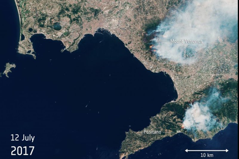
Hot, dry conditions are encouraging the spread of wildfires in southern Italy. Flames have destroyed large swaths of forest along the slopes of Mount Vesuvius. Photo by ESA/Copernicus Sentinel

July 14 (UPI) -- Mount Vesuvius is on fire. The European Space Agency has proof in the form of satellite imagery.

With southern Italy suffering a prolonged drought and high temperatures, several wildfires are burning intensely in the region. Strong winds are further fanning the flames, spreading the blazes across the slopes of Mount Vesuvius.
Advertisement

On Wednesday, hundreds of villagers, beachgoers and tourists in Palermo, along the Sicilian coast, had to be evacuated as flames encroached and wind-blown smoke made it hard to breathe.

Many were evacuated by boat, as the road to a series of popular Palermo beaches was made unsafe for travel by the thick plumes of smoke.

Satellite images captured by the Sentinel-2 mission revealed the lines of flames burning along the western slopes of Mount Vesuvius. The new images also revealed a second wildfire burning near the town of Positano on the Amalfi coast.

Local officials report wildfires have destroyed much of the forest comprising Vesuvio National Park.

Though hot, dry conditions are surely fanning the flames, both members of the media and local police believe arsonists affiliated with the mafia are to blame for the fires on Mount Vesuvius.

Advertisement

Latest Headlines