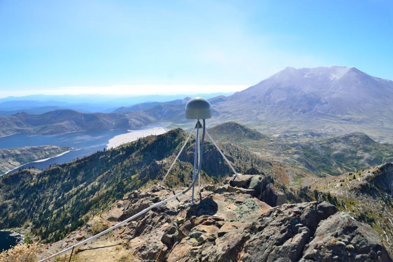
A GPS station drilled atop a peak near Mount St. Helens in Washington State. Photo by Mike Gottlieb/University of Washington
March 28 (UPI) -- The same algorithm that helps traders on Wall Street know when to buy or sell is helping geologists study "slow slip" earthquakes, gradual movement of Earth's tectonic plates.
Researchers at the University of Washington adapted Wall Street's relative strength index, a measure of a stock price's rate of change, to pick out the signatures of slow slips among the seismic noise.
"I've always had an interest in finance, and if you go to any stock ticker website there's all these different indicators," Brendan Crowell, an earth scientist at UW, said in a news release. "This particular index stood out in its ease of use, but also that it needed no information -- like stock volume, volatility or other terms -- besides the single line of data that it analyzes for unusual behavior."
Crowell and his colleagues used the algorithm to analyze data collected from 2005 to 2016 by 200 GPS stations along the West Coast's Cascadia subduction zone, a long plate boundary stretching from northern California to northern Vancouver Island.
"Looking at the Cascadia Subduction Zone -- which is the most-studied slow slip area in the world — was a good way to validate the methodology," Crowell said.
The algorithm successfully identified the same slow slips previously found during more comprehensive surveys.
Normal earthquakes are relatively sudden. Fault slips propagate seismic waves. Slow slips happen over a span of weeks or months, not minutes. The fault line displacement is too gradual to produce seismic waves. Instead, scientists must measure them using GPS.
GPS stations feature sensors fixed to steel pipes penetrating 115 feet into the solid rock. The sensors can measure minute movements in the Earth's crust. Until now, scientists had to compare data from dozens of GPS stations to identify and track slow slips, but the relative strength index can detect a slow slip using data from a single station.
Scientists detailed their success in the Journal of Geophysical Research: Solid Earth.
Lead author Crowell says the new algorithm will help geologists study a variety of geophysical phenomena -- and in places with few GPS stations.
"I want to be able to use this for things beyond slow slip," Crowell said. "We might use the method to look at the seismic effects of groundwater extraction, volcanic inflation and all kinds of other things that we may not be detecting in the GPS data."


