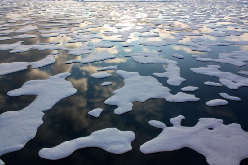
1 of 2 | Sea ice patterns in the Arctic Ocean. Photo by Kathryn Hansen/NASA
TORONTO -- Sea ice cover in the Arctic beat a hasty retreat throughout June, reaching record-breaking levels by month's end.
Data published by the U.S. National Snow and Ice Data Center last week showed average sea ice extent for June was 100,000 square miles smaller than in 2010, the year of the previous June record.
Almost every month this year has set new record lows for sea ice extent. March, however, was the second-lowest, slightly greater than 2015. The average sea ice extent for June was 4.09 million square miles.
"In 30 years, the area has shrunk approximately by half. There doesn't seem to be anything able to stop this trend," said Christian Haas, an Arctic sea ice geophysicist at York University, Toronto.
As the sea ice melts, the ocean loses its reflective cover, allowing it to absorb more solar heat and causing the water to warm. This contributes to warmer air temperatures and more sea ice melt.
Ice cover disappeared relatively slowly in early June, following a change in atmospheric circulation. The high surface pressure that had been over the Arctic Ocean for much of the year shifted to one of low pressure, ushering in more cloud cover. In addition to reducing the amount of sunlight that reaches the ice, the clouds also summoned below-average air temperatures in the Beaufort Sea area.
Despite this, there was more open water than average in the Beaufort Sea in June, as well as in the Kara and Barents Sea, the NSIDC said. Ocean currents and wind also affect the state of the sea ice, said Haas.
During late April and early May, NASA's Operation IceBridge flew aircraft missions to estimate the sea ice thickness between Alaska and the North Pole. It found the first-year ice was generally thinner than typical at the end of the winter, which was consistent with the very high temperatures seen this past winter.
Haas' own studies measuring ice thickness in the Beaufort Sea in April found similar results, using a different technique.
"The first year is more than 50 percent thinner than usual, but the multiyear ice hasn't changed," he said.
Scientists at the University of Washington tallied the volume of Arctic sea ice floating in the ocean. By their estimates, the total mass of Arctic sea ice is at its second-lowest recorded volume for the beginning of July.
Climate scientist Ed Hawkins, from the University of Reading in the U.K., depicted the decline in sea ice volume between 1979 and 2016 in a spiral graphic similar to the one he created earlier in the year for global temperatures.
In addition to capturing the overall trend in sea ice volume, the graphic shows the seasonality of sea ice volume, with the curve flattening in September.
Despite the suggestions that this year could see the lowest Arctic sea ice extent ever recorded in September, many scientists are shying away from such predictions. Of the 30 contributions submitted to the Sea Ice Outlook for June, only one forecasts a new record low for September and another foresees a tie with 2012.
Year-to-year variation occurs, and the sea ice can recover if temperature, cloud cover and winds favor less ice melt.
Researchers at the University of Reading told BBC News that the relatively low prevalence of ponding water on top of the ice floes in May suggested a new record was unlikely. These melt ponds absorb more sunlight, increasing the melting of the ice from above.
Winter sea ice extent doesn't always predict summer sea ice extent, said Haas. While the majority of the Arctic sea ice is contained within the Arctic Ocean, "in the winter, the maximum state is determined by the marginal seas, the Barents and the Kara seas," he said. "They have very little potential to predict summer sea ice conditions." December's large Arctic cyclone brought warm air into the region, particularly in the Barents and Kara seas.
"We can watch air temperature and winds, in particular, and, in generally, the behavior of the ice extent," said Haas. "But there isn't much more you can do -- and there is nothing we can do to stop it."
This article originally appeared on Arctic Deeply, and you can find the original here.
For important news about Arctic geopolitics, economy, and ecology, you can sign up to the Arctic Deeply email list."


