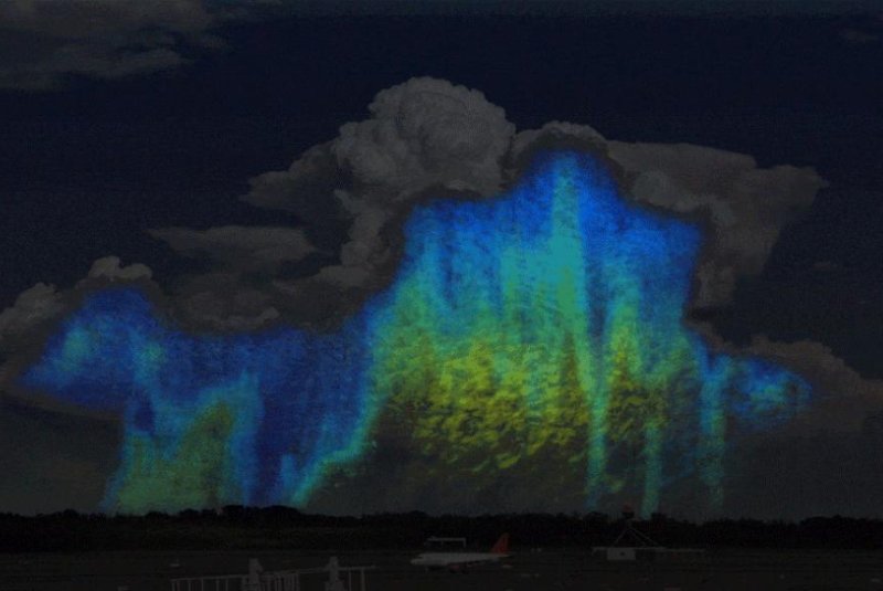
Data from NASA's Global Precipitation Measurement mission is helping scientists map storm clouds and precipitation droplets in 3-D. Photo by NASA/JAXA
GREENBELT, Md., March 31 (UPI) -- The Global Precipitation Measurement mission, coordinated by the space agencies of the United States and Japan, is helping scientists understand the formation and behavior of storms.
Data collected by NASA and JAXA satellites have allowed scientists, for the first time, to create 3D images of raindrops and snowflakes falling all over the world.
"The drop size distribution is one of many factors that determines how big a storm will grow, how long it will last and how much rain it will ultimately produce," Joe Munchak, research meteorologist at NASA's Goddard Space Flight Center, said in a news release. "We've never been able to see how water droplet sizes vary globally until now."
The size of a raindrop depends predominantly upon two factors: where in the atmosphere a cloud forms and where in the cloud the raindrop originates.
Rain clouds feature a variety of water droplet sizes. The largest drops are usually found in the center of a cloud, where moisture is constantly colliding and coalescing, accumulating size.
The locations of raindrops or snowflakes of different sizes within a cloud system is known as "particle size distribution." For the first time, satellite data -- and the GPM mission -- is allowing scientists to map this distribution.
Ratios of medium to large drops can help meteorologists predict how much precipitation a storm system is going to produce, but until recently, ascertaining those ratios has proven difficult.
"Without knowing the relationship or the ratio of those large drops to the smaller or medium sized drops, we can have a big error in how much rain we know fell and that can have some big implications for knowing long term accumulations which can help with flash flood predictions," said Munchak.
Precipitation size also affects the behavior and evolution of storm clouds. Smaller droplets are more easily evaporated and more efficiently cool the air as they fall to the ground. The cooler air creates stronger downdrafts which can result in damaging winds on the ground. They also slow the updraft of warmer air, which starves the storm of new energy, causing the storm to dissipate.
"GPM measurements will really help predict these complex interactions that depend in part of the drop size distribution," said Munchak.


