Advertisement

NASA satellite photographs record-breaking Hurricane Pali

The hurricane is moving at a pace of 7 miles per hour, with sustained winds of 90 miles per hour.

By Brooks Hays
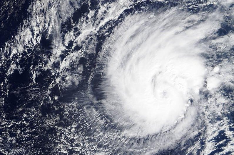
A research satellite imaged Tropical Storm Pali just hours before it was officially declared a hurricane, setting a record for earliest Pacific hurricane. Photo by NASA/MODIS

HONOLULU, Jan. 12 (UPI) -- At 5:30 p.m. EST on Monday, NASA's Terra satellite captured an image of Tropical Storm Pali. Less than five hours later, the rapidly strengthening system was declared a hurricane.

The declaration -- just 11 days into the new year -- set a record as Pali became the earliest hurricane to be declared in the central Pacific basin.
Advertisement

The newly captured image, snapped by Terra's MODIS camera, reveals the eye of the hurricane, with dense bands of thunderstorms spinning out from the center. The system is currently moving south and located far to the southwest of Hawaii -- 1,345 miles southwest of Honolulu. No coastal advisories or warnings are currently in effect.

"After exhibiting a rather well defined eye through the evening...a recent burst of deep convection around the center of Hurricane Pali has caused the eye to become cloud filled...likely due to southwesterly vertical wind shear of around 15 knots," NOAA forecaster Derek Wroe told NASA.

The hurricane is moving at a pace of 7 miles per hour, with sustained winds of 90 miles per hour. More warm water lies in its path, which usually means the system will continue to strengthen, but forecasters say wind shearing will slow the storm in the coming days.

Advertisement

Latest Headlines