Advertisement

Underwater search reveals details of 'Britain's Atlantis'

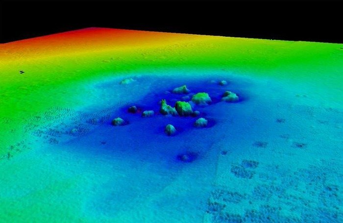
3D visualization of Dunwhich's St Katherine's church, now hidden below the surface of the sea. Credit: University of Southampton

SOUTHAMPTON, England, May 9 (UPI) -- A British researcher says he's conducted a detailed analysis of the archaeological remains of the lost medieval town of Dunwich, dubbed "Britain's Atlantis."

Using advanced underwater imaging techniques, the project led by Professor David Sear of the University of Southampton has produced the most accurate map to date of the town's streets, boundaries and major buildings and revealed new ruins on the seabed, a university release reported Thursday.
Advertisement

Present day Dunwich is a village 14 miles south of Lowestoft in Suffolk, but it was once a thriving port, similar in size to 14th Century London, until a huge storm in 1268 swept much of the settlement into the sea and silted up the Dunwich River.

More storms silted up the harbor, leading to the town's eventual demise as a major international port in the 15th Century.

It now lies collapsed and in ruins 10 to 30 feet below the surface of the sea just off the current coastline.

"The loss of most of the medieval town of Dunwich over the last few hundred years -- one of the most important English ports in the Middle Ages -- is part of a long process that is likely to result in more losses in the future," coastal survey expert Peter Murphy of English Heritage said. "Everyone was surprised, though, by how much of the eroded town still survives under the sea and is identifiable."

Advertisement

Latest Headlines