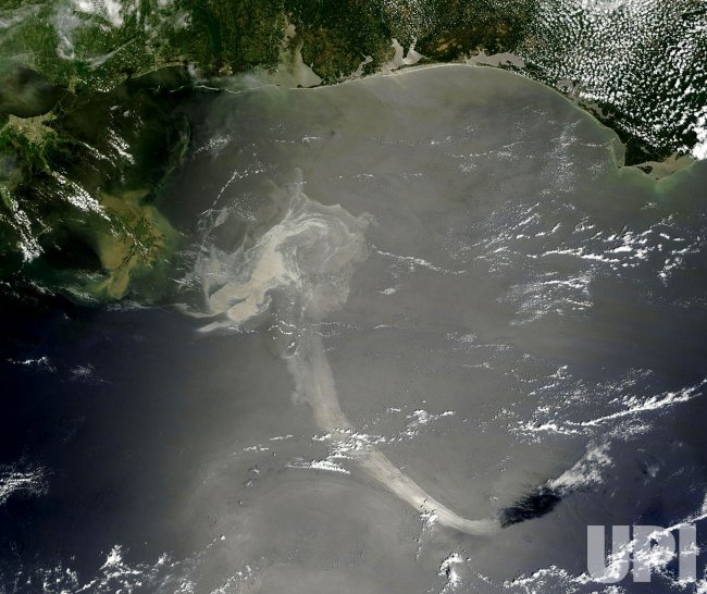
NASA Satellite Captures Oil Spill in the Gulf
NASA's Terra satellite captured a visible satellite image of the Gulf oil spill on May 17, 2010 from the Moderate Resolution Imaging Spectroradiometer Instrument on-board. The oil slick appears as a dull gray on the water's surface and stretches south from the Mississippi Delta with what looks like a tail. From top left to top right are the states Louisiana, Mississippi, Alabama and Florida. Scientists are worried that the huge plumes of oil could get into a current that would take the oil around Florida. UPI/NASA
