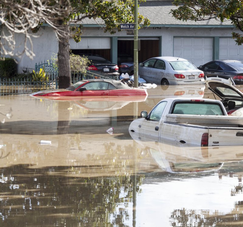
Vehicles sit stranded along Welch Avenue in the Coyote Creek area of San Jose, Calif., after heavy rains in recent days triggered severe flooding. Authorities said it is the worse flooding in the area in more than 100 years. Photo by Peter DaSilva/EPA
Feb. 23 (UPI) -- Thousands of residents in Northern California were allowed to go back home Thursday after historic flooding this week forced them out -- but officials say they're not out of the woods yet.
Forecasters are calling for rain and thunderstorms -- and colder temperatures -- this weekend in the San Jose area, which could further aggravate the situation.
"For people not used to the cold, we are going to get a little cold snap," said Matt Mehle, a forecaster with the National Weather Service. "This system doesn't look like it's going to be producing a ton of rainfall overall."
About 36,000 homes in various neighborhoods of the San Jose metro area were affected this week after heavy rains into Anderson Lake filled the Coyote Creek beyond its banks on Monday. The flooding was so bad it covered parts of U.S. Highway 101.
The rains also caused a levee break near the city of Stockton.
Authorities have said the flooding is the San Jose area's worst in more than a century.
The new storm is expected to arrive late Friday and continue through the weekend. However, forecasters expect that the actual precipitation will mostly be limited to higher-elevation areas instead of the San Jose metro area. About a half-inch is expected to fall further north in the San Francisco and Oakland areas.
The same creeks and streams that flooded this week, though, could again breach their banks if too much rain falls in the Santa Cruz Mountains and North Bay mountains.
"Creeks and streams could respond quickly," Mehle said.
"Bluntly, the water is receding, but we are far from out of this," San Jose Mayor Sam Liccardo said Wednesday.
Temperature-wise, the entire Bay Area is expected to feel some chill -- with lows in the low 40s, and possibly upper 30s, all weekend.
Further northeast, flood watches and warnings remained in effect on the Sacramento River.
"Releases from Shasta Reservoir will keep the Upper Sacramento River at high flows for the next several days," the NWS said in an advisory Thursday morning.
About 150 miles further northeast, work continues on the Lake Oroville spillway, which sprung a serious leak last week and forced thousands to evacuate.


