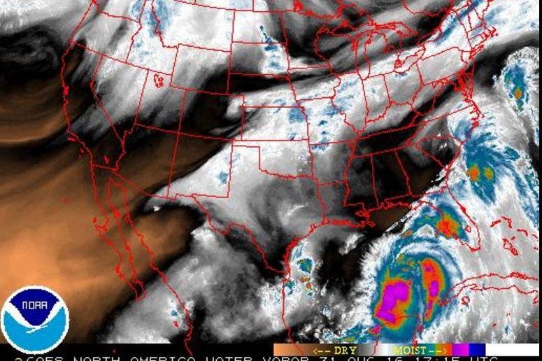
1 of 3 | A water vapor satellite image displays large amounts of precipitation in Tropical Storm Hermine as it swirls in the Gulf of Mexico off Florida's west coast on Wednesday. Image courtesy National Weather Service
MIAMI, Aug. 31 (UPI) -- Residents of Florida's western flank are under a hurricane watch for the first time in four years as a tropical storm picks up speed nearby and threatens to bring serious trouble in the next 24 hours, forecasters said Wednesday.
Tropical Depression 9 bulked up into Tropical Storm Hermine early Wednesday afternoon in the Gulf of Mexico, ahead of schedule, and prompted priority readiness measures and emergency declarations for 42 central and western Florida counties.
As of 1 p.m. CDT Wednesday, the storm packed maximum sustained winds of 40 mph -- just barely above the tropical storm threshold -- and was located about 350 miles southeast of New Orleans and 365 miles west of St. Petersburg.
"We expect the storm to make a curve to the northeast at midweek and should make landfall north of Tampa and perhaps close to Apalachicola, in the Big Bend of Florida during Thursday evening," according to AccuWeather Hurricane Expert Dan Kottlowski.
Hermine could dump between 4 to 8 inches of rain with 12 inches possible in some spots, causing flooding in urban and low-lying areas.
Florida Gov. Rick Scott said he issued states of emergency for the western Florida counties to get ahead of potential trouble.
"By declaring a state of emergency in advance of this storm, we are ensuring that state, regional and local agencies can work together to meet the needs of our communities," he said in a statement.
A forecast map by the U.S. National Weather Service highlights areas in Florida's "Big Bend" that are susceptible to 6-foot coastal surges expected from Tropical Storm Hermine, which picked up steam in the Gulf of Mexico on Wednesday about 350 miles almost due west of St. Petersburg, Fla. Image courtesy National Weather Service
"It is crucial that every Floridian has a plan in place to ensure their families, homes and businesses are fully prepared."
About 8,000 members of the Florida National Guard are on standby to aid residents ahead of the storm, the governor stated.
Earlier Wednesday, the National Hurricane Center issued a tropical storm warning for Florida's Gulf coast from the Anclote River to the Walton/Bay County Line -- and a hurricane watch from the Anclote River to Indian Pass, meaning hurricane conditions are possible within that area.
Forecasters said the storm is expected to make landfall along the Big Bend area of Florida's west coast early Thursday. Before then, however, it might again cross the threshold -- 74 mph winds -- and become Hurricane Hermine.
If it strengthens before making landfall, Hermine will be the first hurricane to hit any part of Florida since 2005.
As many as 10 inches of rain could soak central and north Florida through Friday and some isolated parts could see as many as 15 inches. Meteorologists said scattered tornadoes and flash flooding could also arrive with the system.
Democratic vice presidential candidate Tim Kaine canceled a scheduled trip to Florida due to the storm threat.
Coastal surge as high as 6 feet could also make land from Gulf to Pasco counties, the hurricane center said.
The tracking forecast of the storm system shows that after hitting Florida Thursday, the storm should dissipate and pass over Georgia and the Carolinas on its way to the Atlantic Ocean. Once back in the open sea, the system could refuel and approach the Northeast and threaten Rhode Island and Massachusetts.
Forecasters said another storm, Tropical Depression 8, is moving slowly away from the North Carolina coast and into the open Atlantic. That storm has maximum sustained winds of 35 mph and is located about 130 miles southeast of Virginia Beach, as of late Wednesday morning. It is not expected to make landfall.


