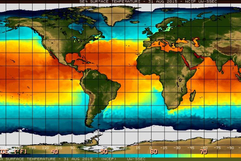
A map of current sea surface temperatures. Photo by NOAA/NASA
GENEVA, Switzerland, Sept. 1 (UPI) -- El Nino is the name given to the climatic effects of warming waters in the Pacific Ocean.
As a significant portion of the ocean warms to above-average temperatures, the cross-Pacific trade winds slow and strong patterns of clouds and heavy rain begin to develop near the international date line. The event can disrupt weather patterns all over the world.
According to a new report from the World Meteorological Organization, the current El Nino event is "mature and strong." Scientists at the WMO say the event will continue to strengthen through the end of the year, with temperatures rivaling the strongest El Nino events in recorded history.
"Models and expert opinion suggest that surface water temperatures in the east-central tropical Pacific Ocean are likely to exceed 2 degrees Celsius above average," the researchers write, "potentially placing this El Niño event among the four strongest events since 1950."
Surface water temperatures in the Pacific are already well above average, and if they continue to rise at hastening pace, the current El Nino could best the strongest event, recorded in 1997-1998.
El Nino events can have significant effects on weather systems around the world -- causing droughts in some places, while encouraging flooding in others.
Typically, exceptionally warm Pacific waters precipitate dry spells in Asia and heavy rains in many parts of North America. Similarly, El Nino typically means drier weather in southern Africa and flooding around the Horn of Africa.
Storms in the Atlantic Ocean and Gulf of Mexico are usually quelled by a prolonged El Nino event, while more violent weather is stirred up in the eastern Pacific.
Meteorologists say the current El Nino has already served to quiet the South Asian monsoon season.
"We are seeing that the Indian monsoon right now is almost 12 percent below normal. There is only a month left of the summer monsoon season making it difficult to recover," WMO's El Nino expert Rupa Kumar Kolli told the BBC.
But predicting the effects if El Nino is more complicated this time around, as climatologists have yet to fully understand how the event will interact with the Arctic warming effect, which has slowed the jet stream running across North America.
"The truth is we don't know what will happen," David Carlson, the director of the World Climate Research Program, told reporters. "Will the two patterns reinforce each other? Will they cancel each other? Are they going to act in sequence? Are they going to be regional? We really don't know."


