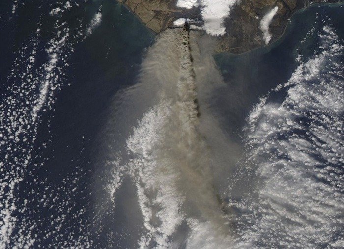
On April 17, 2010, the Moderate Resolution Imaging Spectroradiometer (MODIS) satellite instrument captured this image of the Eyjafjallajokull volcano in Iceland erupting and spreading a huge ash plume over northern Europe. Credit: NASA
LANGLEY, Va., Oct. 25 (UPI) -- NASA says its Earth-observing satellites are helping improve forecasts of ash clouds from volcanic eruptions that can be major disruptions of aviation services.
Volcanic ash -- with hard, jagged particles that can be blown thousands of miles away from their source -- is quite dangerous to airplanes, grounding and diverting flights with a huge economic impact to travelers, NASA researchers said.
The eruption of Eyjafjallajokull, a volcano in Iceland, produced a large plume over the airspace of Europe, grounding more than 100,000 travelers in 2010 with an impact of more than $1 billion.
"The Icelandic eruption, such a dramatic event, made us take a hard look at what each of our satellites can tell us," said John Murray with the NASA Applied Sciences Program's natural disasters focus area. "We knew we needed to understand how to integrate them to make better forecasts."
The unique capabilities of NASA satellite imagery can improve warnings produced by the world's nine operational Volcanic Ash Advisory Centers, researchers said.
"The dispersion of a volcanic plume in the atmosphere is like ink in water," Jean-Paul Vernier, a scientist at NASA's Langley Research Center, said. "Models, which are used to simulate both, rely on source information like how much ink or ash is introduced and how the flow -- either the current or wind -- transports the material."
For plumes typically injected at higher altitudes near commercial airline cruise levels, forecasters need constantly refreshed information about height and location, which is where NASA satellite data comes in, he said.


